Immersion in the Himalayas

Scroll down to see more

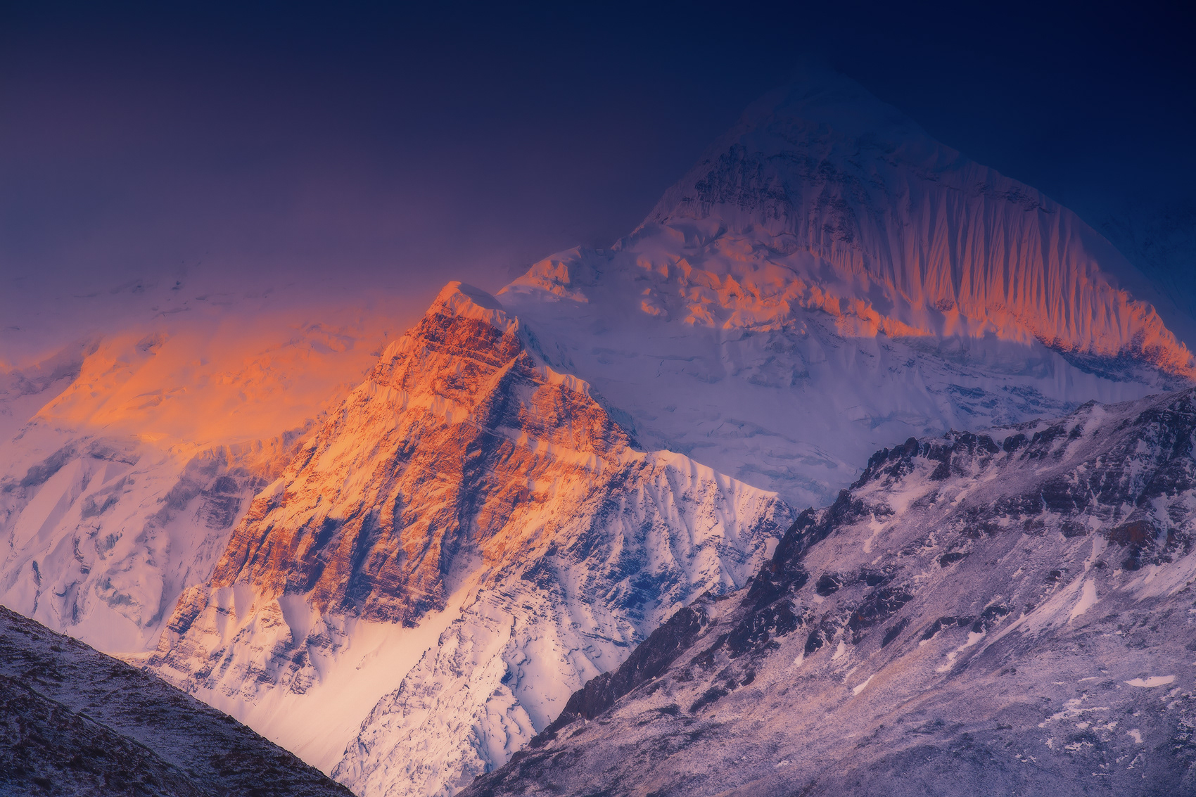
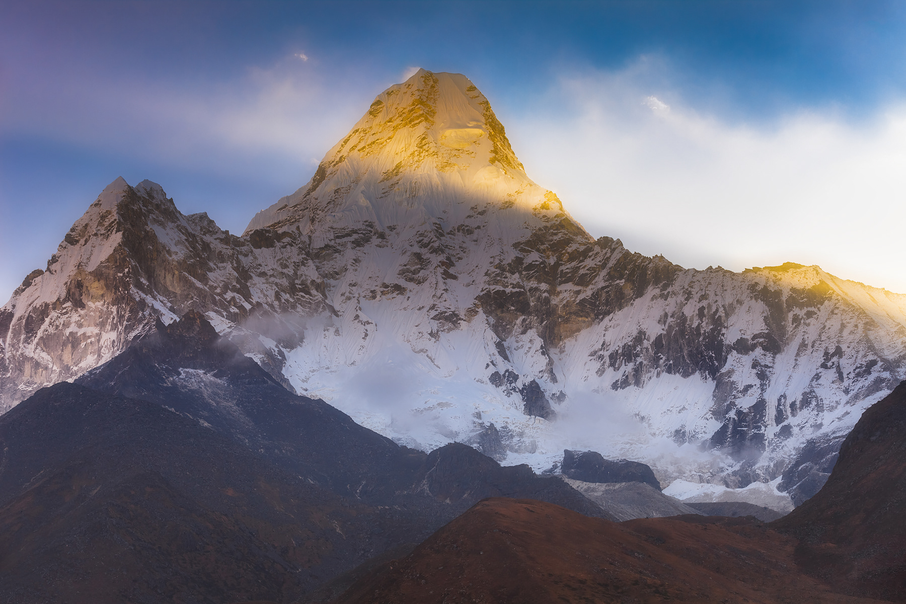
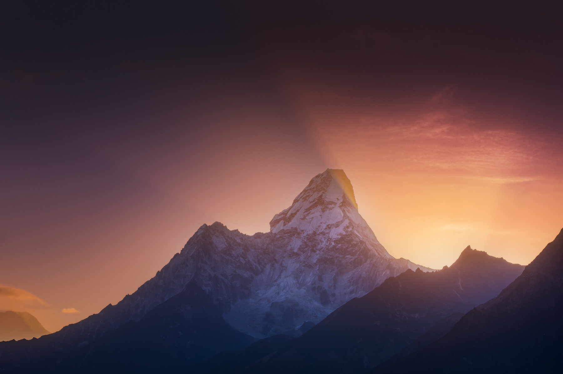
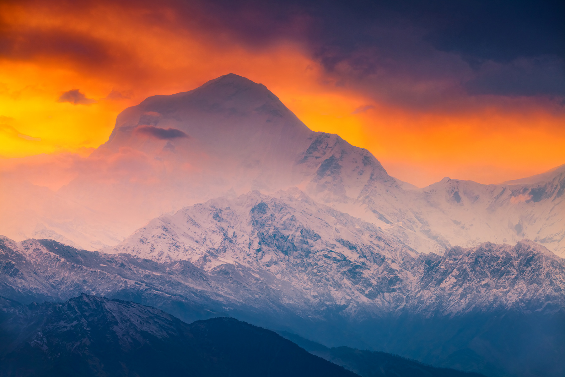
Amazing sunrise over mountain Ama Dablam in Khumbu valley - the one of the most famous and spectacular peaks in the World.

View on Toboche Peak from a trail to Dole

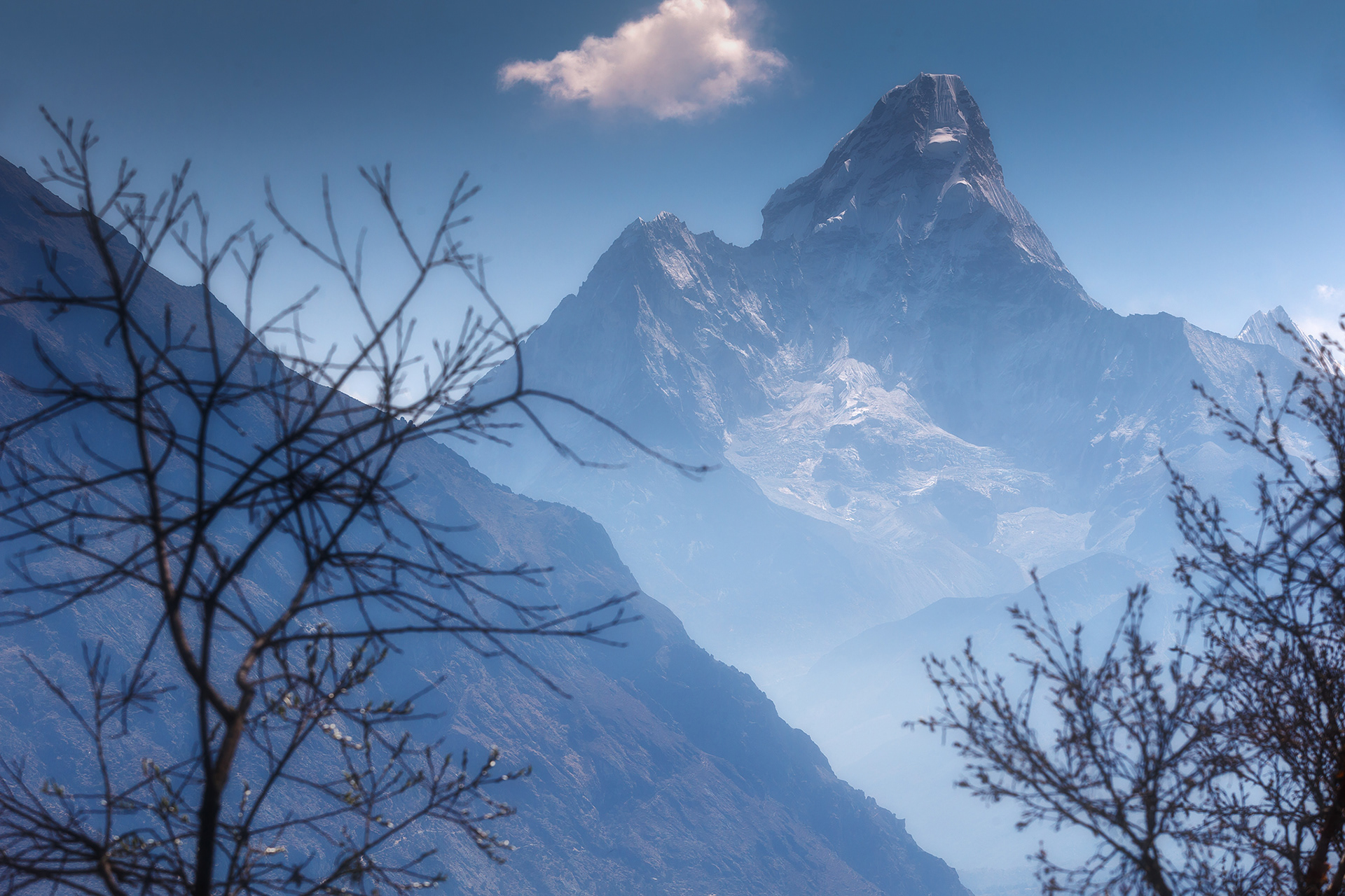
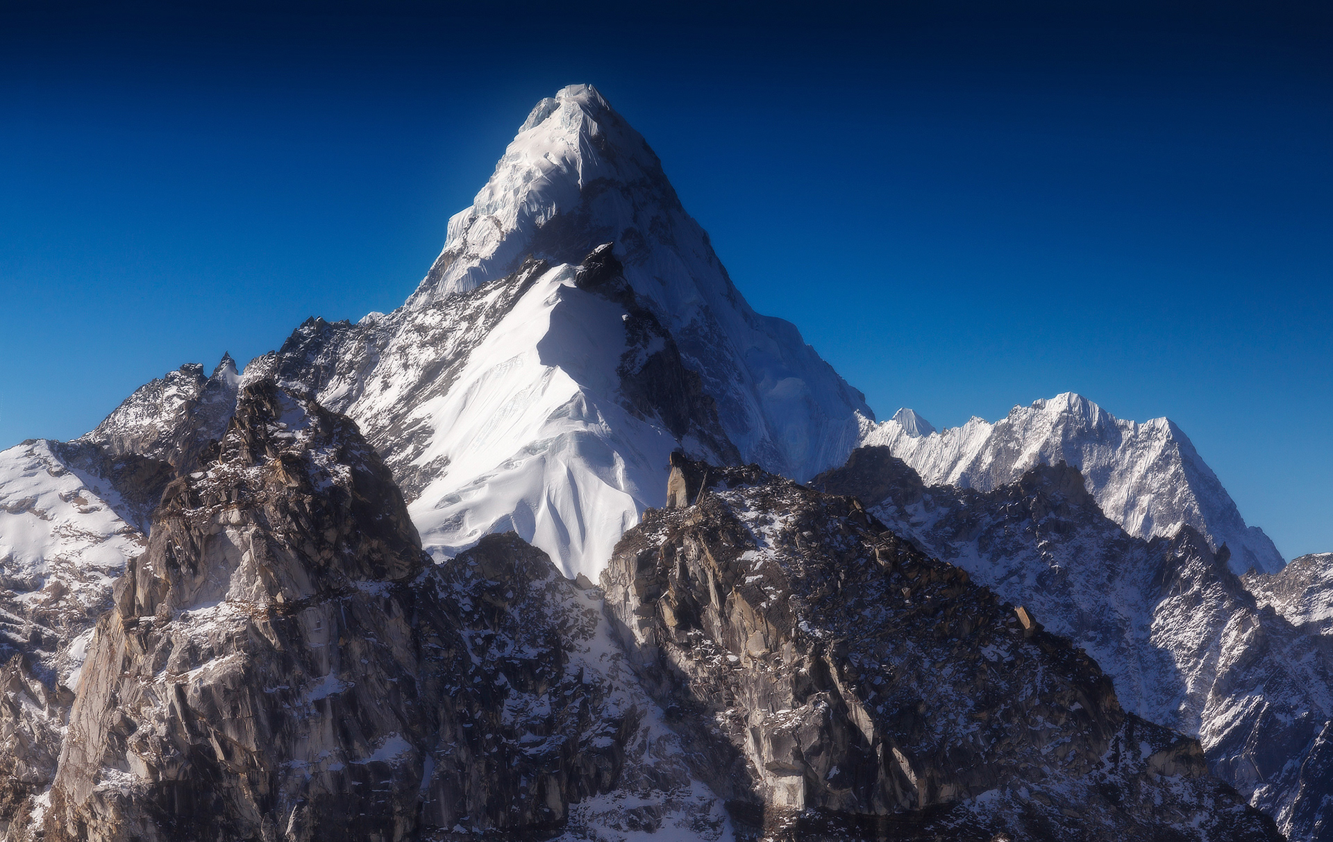
View on mountain Ama Dablam from Mon La pass


Rays of the setting Sun lit up the valley and as if awakened by the mighty peak Tengkang Poche, forcing the clouds momentarily parted in front of a Mountain

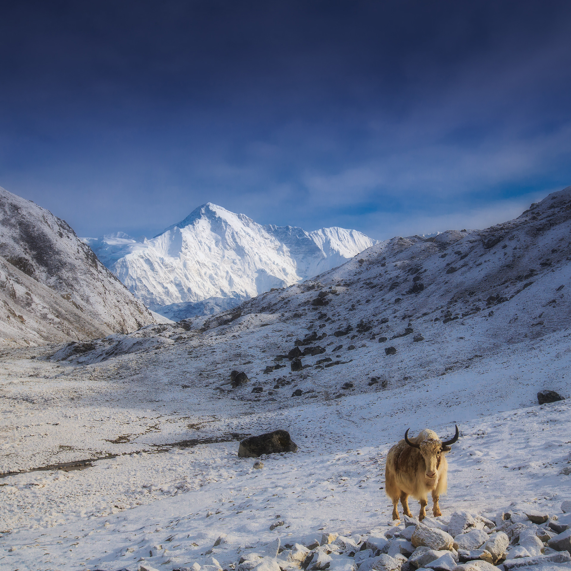
Shaggy Yak on the background of the eight-thousander Cho Oyu, Gokyo Lakes, Sagarmatha National Park

Sunset view Thamserku (6608 m) and Kangtega (6,782 m), known also as The Snow Saddle - a major mountain peaks of the Himalayas in Nepal. Its summit rises metres (22,251 ft). It was first ascended in 1964. The first ascent on Thamserku was made in 1964 from the south by members of Edmund Hillary's Schoolhouse Expedition: Lynn Crawford, Pete Farrell, John McKinnon, Richard Stewart and Phu Dorje Sherpa. Below the basin on the southwest face, they reached the south ridge after climbing a difficult couloir. The team described the climb as difficult and the route has not been repeated in its entirety by anyone else. In 2014, Russian climbers Alexander Gukov and Alexey Lonchinskiy made the first ascent on the southwest face.

Himalchuli is the second highest mountain in the Mansiri Himal, part of the Nepalese Himalayas. It lies south of Manaslu, one of the Eight-thousanders. Himalchuli has three main peaks: East (7893 m), West (7540 m) and North (7371 m). It is also often written as two words, "Himal Chuli". Himalchuli is the 18th highest mountain in the world (using a cutoff of 500m prominence, or re-ascent). Himalchuli is also notable for its large vertical relief over local terrain. For example, it rises 7000m over the Marsyangdi River to the southwest in about 27 km (17 mi) horizontal distance.

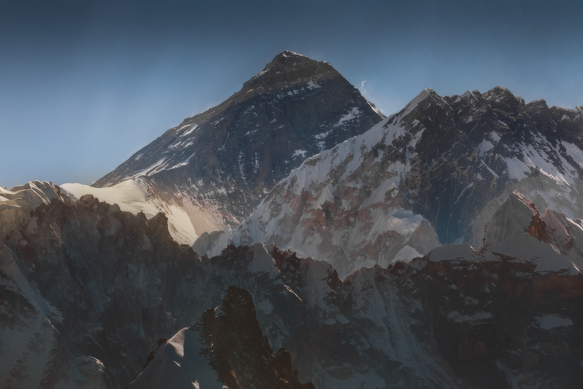
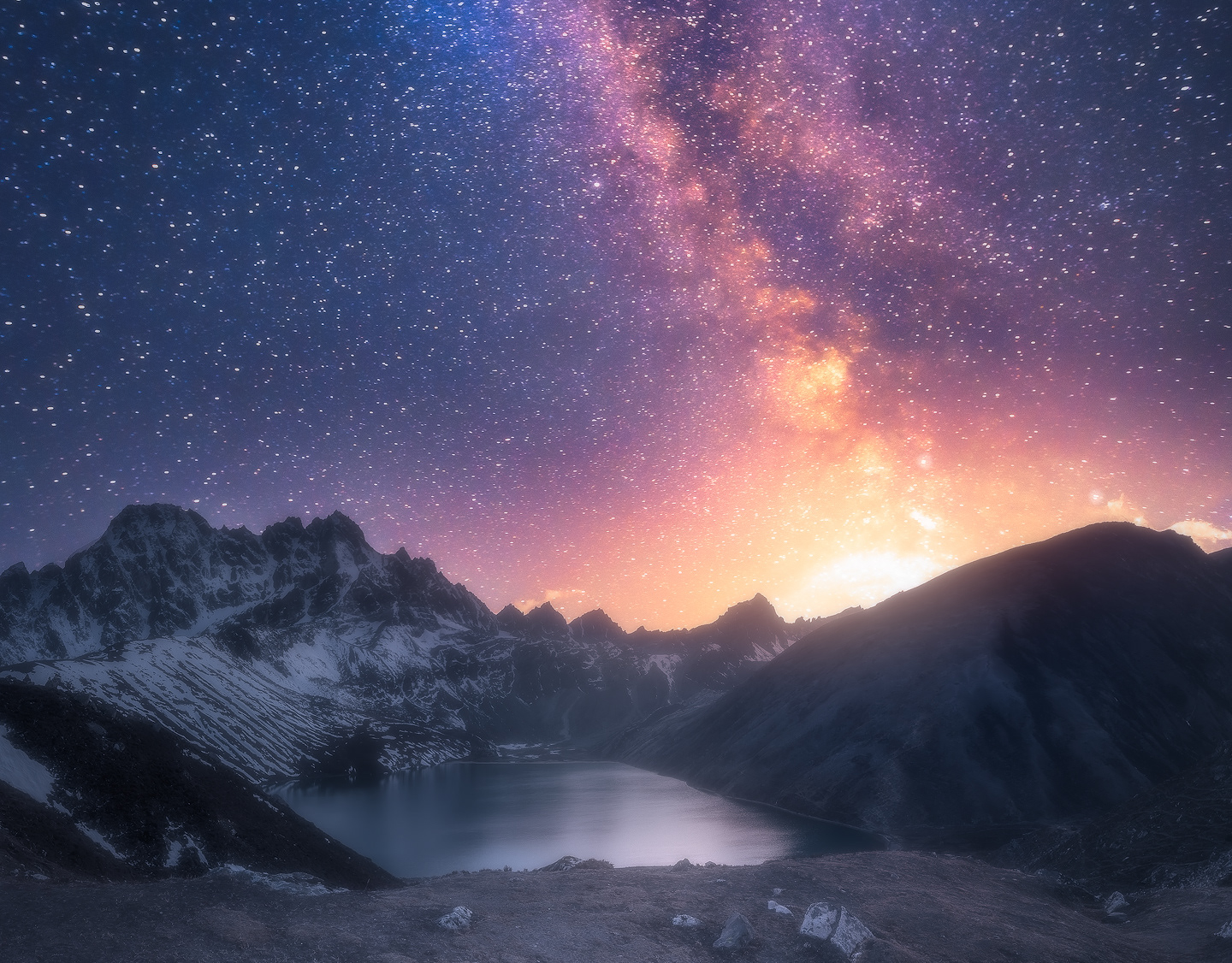
Sunrise over Himalayan peaks in Sagarmatha National Park

First light touched the summit of mountain Ama Dablam, Sagarmatha National Park
Morning view on mountain Pharilapche from Tiengboche Monastery, Sagarmatha National Park

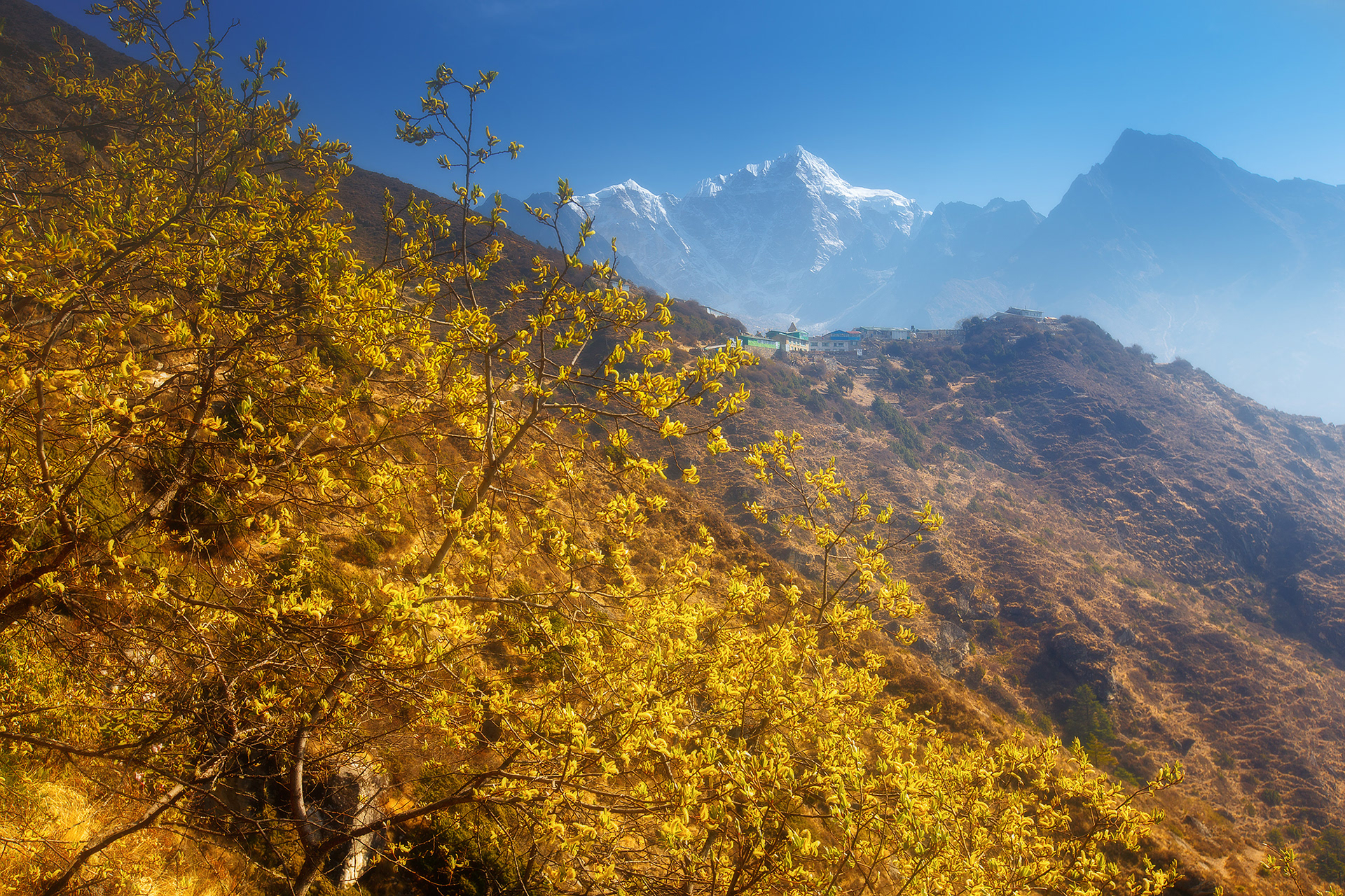
Spring colours of Himalayas and Toboche Peak on background

Sunrise behind mountain Ama Dablam, Pangboche, Sagarmatha National Park

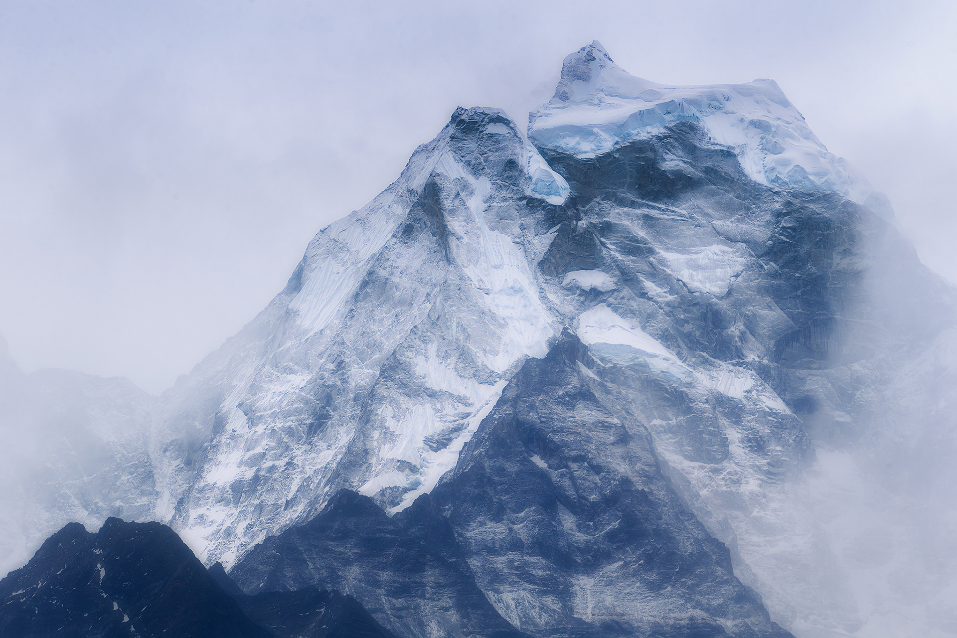
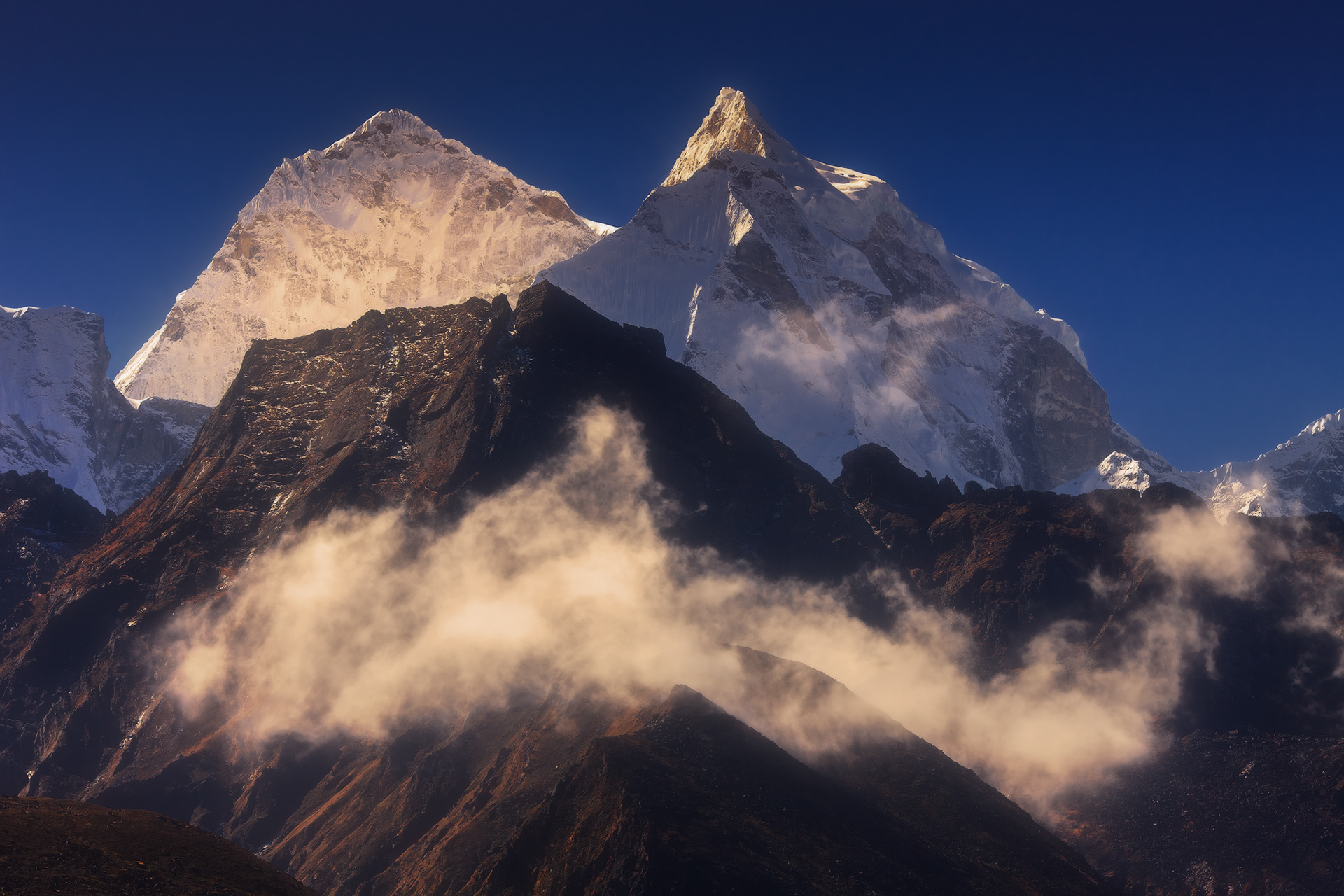
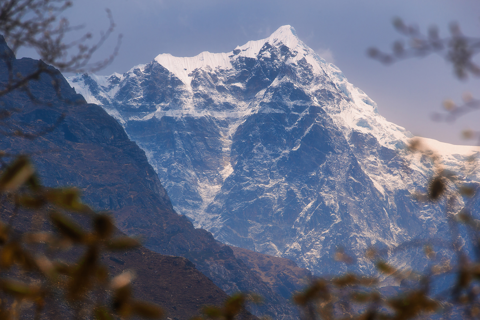
"The Snow Saddle" - mountain Kangtega, view from Dole

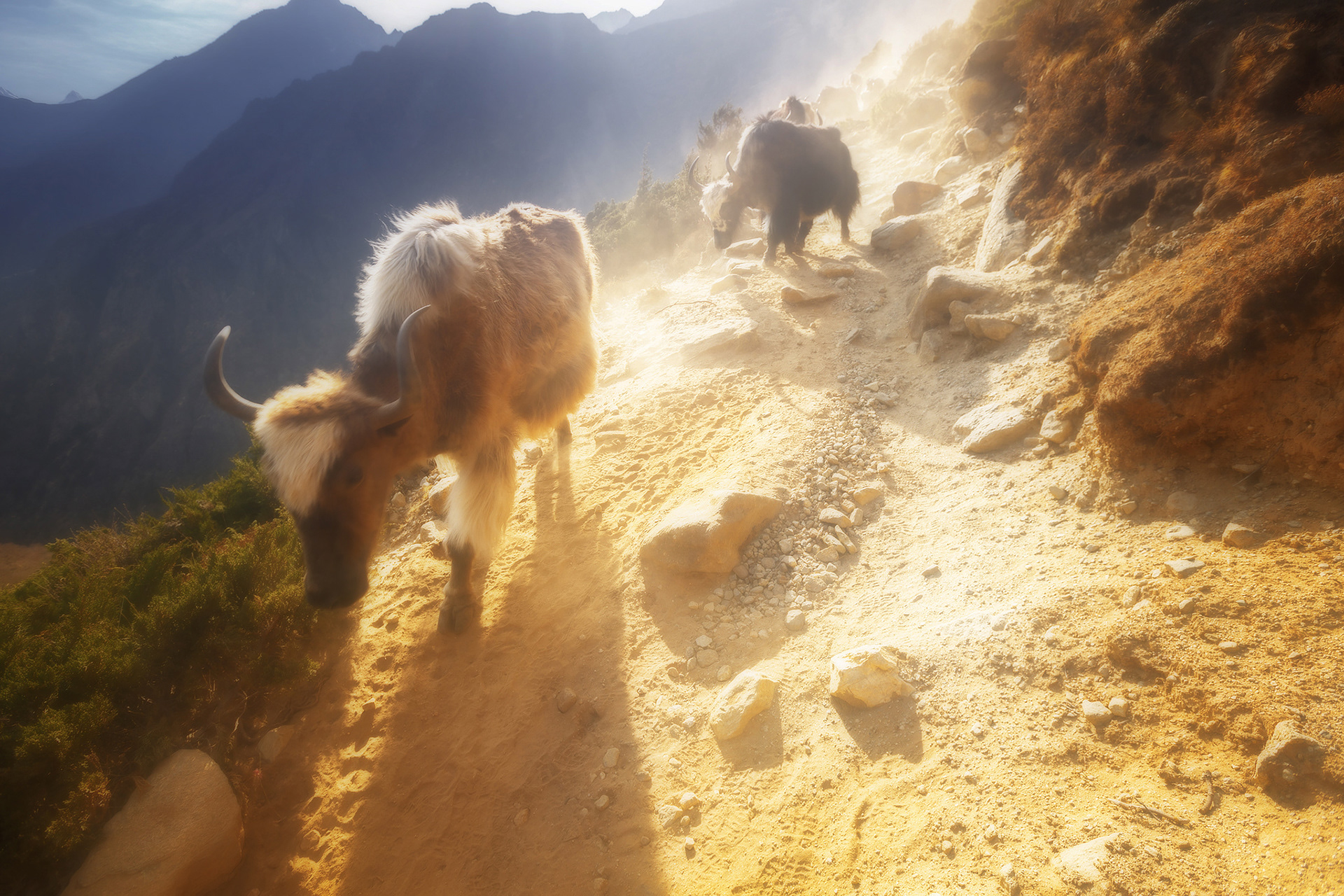
Caravan of Yaks, Sagarmatha National Park

Sunrise in Khumbu Valley, Sagarmatha National Park
View on massif Lhotse-Nuptse and Everest, Sagarmatha National Park
Cholatse (also known as Jobo Lhaptshan) is a mountain in the Khumbu region of the Nepalese Himalaya. Cholatse is connected to Taboche (6,501m) by a long ridge. The Chola glacier descends off the east face. The north and east faces of Cholatse can be seen from Dughla, on the trail to Mount Everest base camp.
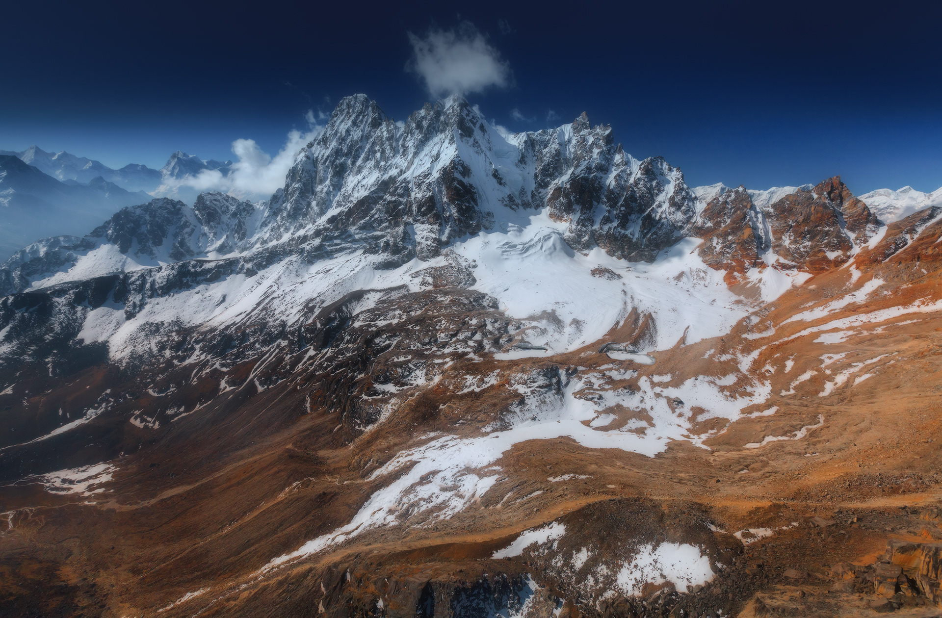
There is a lake just below this pass to the east, and in Tibetan 'cho' is lake, 'la' is pass, and 'tse' is peak so Cholatse means literally "lake pass peak".Cholatse was first climbed via the southwest ridge on April 22, 1982 by Vern Clevenger, Galen Rowell, John Roskelley and Bill O'Connor. The north face was successfully scaled in 1984.

Sunset on Ngozumpa Glacier. The Ngozumpa glacier, below the sixth highest mountain in the world Cho Oyu in Nepal, at 36 kilometres (22 mi), is the longest glacier in the Himalayas. Ngozumpa Glacier is a large persistent body of ice. It flows slowly due to stresses induced by its weight.
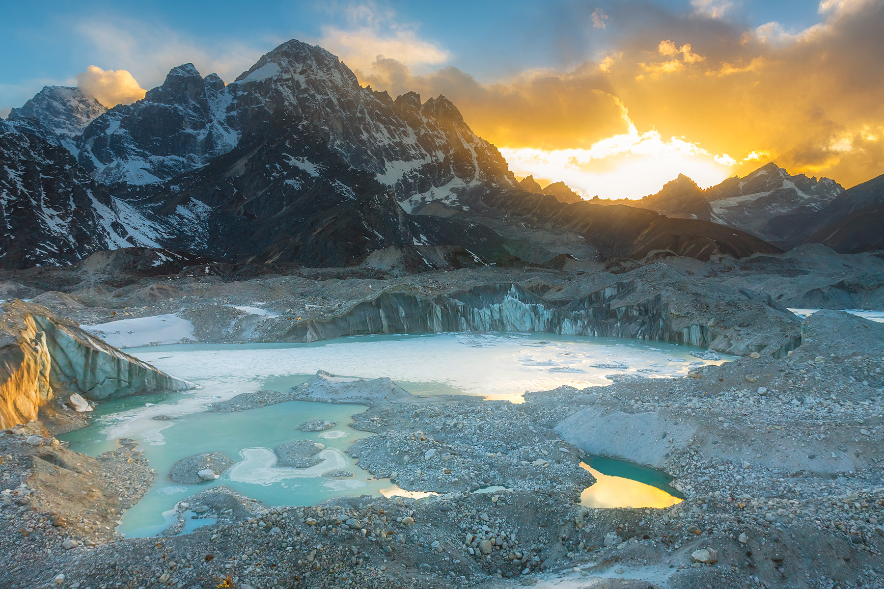
The Nepali Himalayas are warming significantly in recent decades. Ngozumpa glacier is showing signs of shrinking and thinning, producing melt water. Some of this water pools on the surface where an enormous lake is growing. This lake, called Spillway, has the potential to be about 6 kilometres (3.7 mi) long, 1 kilometre (0.62 mi) wide and 100 metres (330 ft) deep. In the future this might be a threat to the Sherpa villages down the valley.

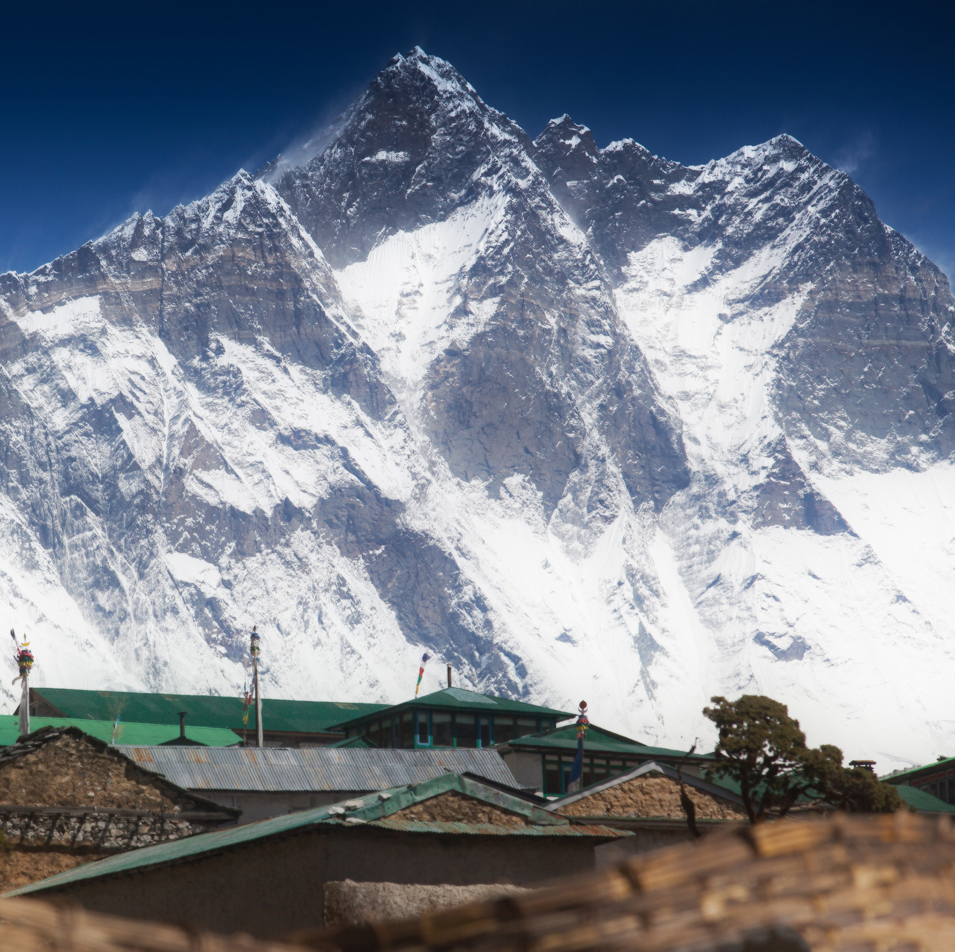
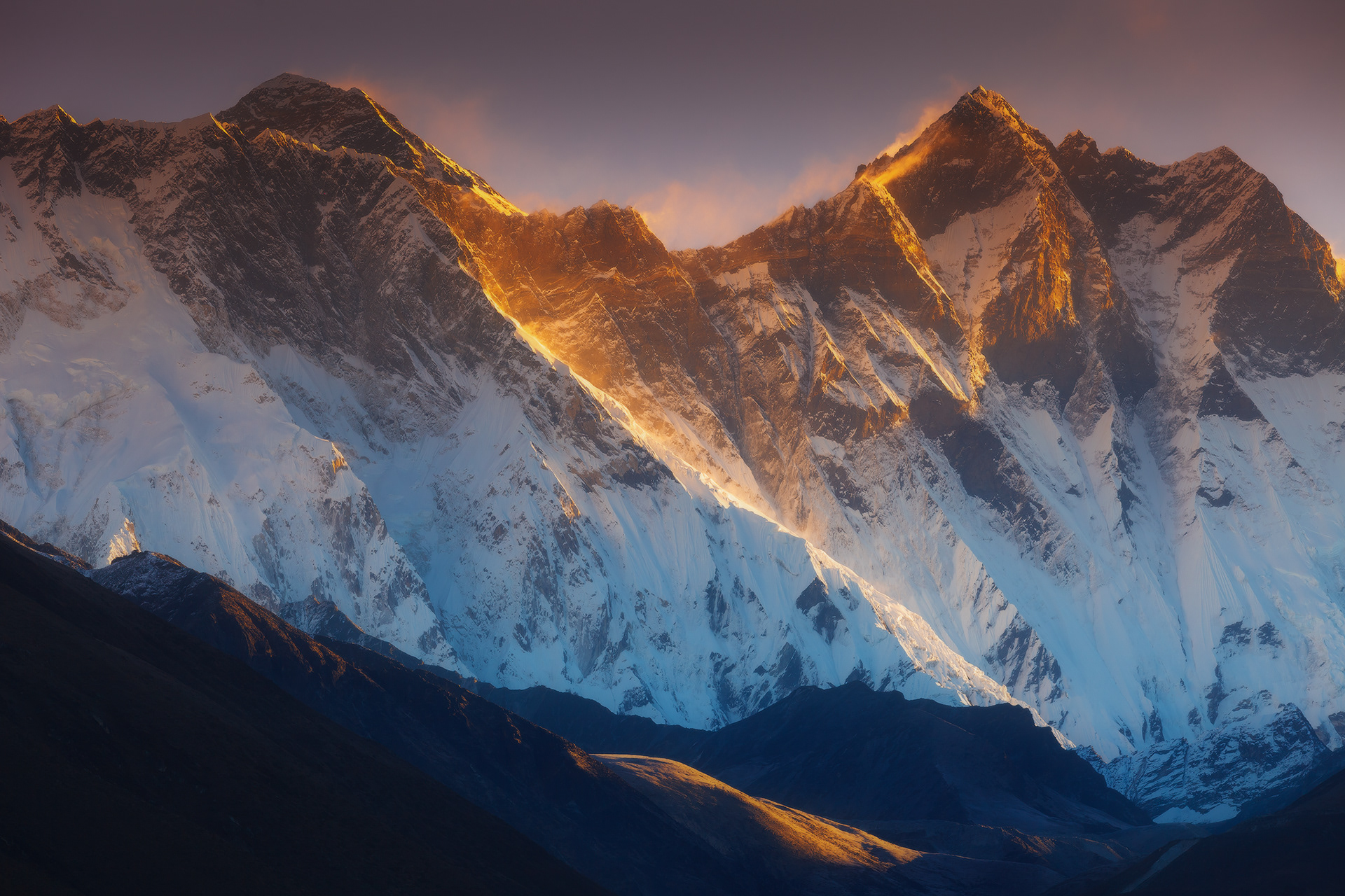
Village Pangboche and  mighty wall of mountain Lhotse

Highland lake on Shipton-La pass, Makalu-Barun National Park

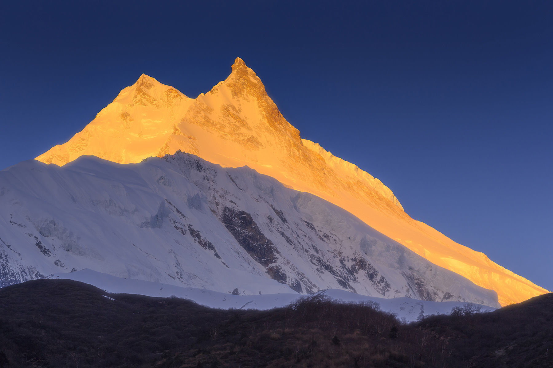
First sunlight on double-peaks of Mansiri Himal, Manaslu Conservation Area

Makalu - is the fifth highest mountain in the world at 8,485 metres (27,838 ft). It is located in the Mahalangur Himalayas 19 km (12 mi) southeast of Mount Everest, on the border between Nepal and China. One of the eight-thousanders, Makalu is an isolated peak whose shape is a four-sided pyramid.
Makalu has two notable subsidiary peaks. Kangchungtse, or Makalu II (7,678 m) lies about 3 km (2 mi) north-northwest of the main summit. Rising about 5 km (3.1 mi) north-northeast of the main summit across a broad plateau, and connected to Kangchungtse by a narrow, 7,200 m saddle, is Chomo Lonzo (7,804 m)

Sacred mountain Machapuchare ("Fish Tail") at the sunrise, view from Poon Hill, Annapurna Conservation Area, Nepal.

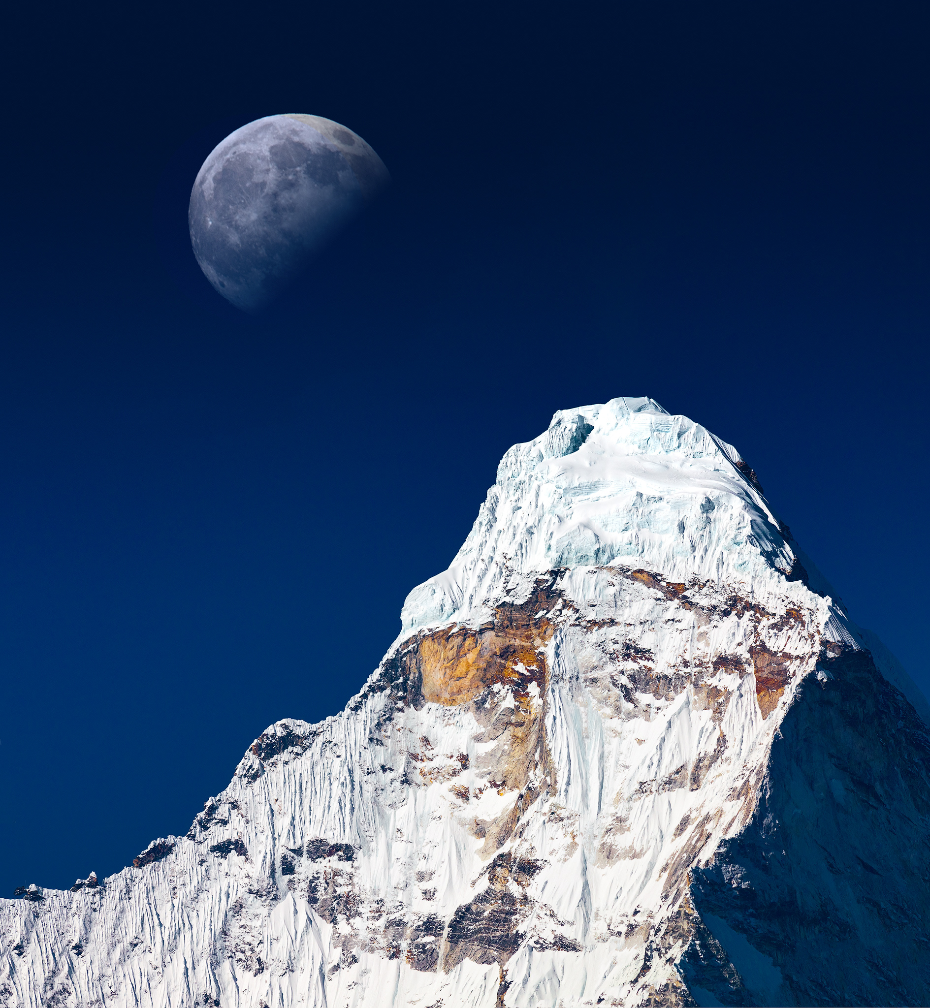
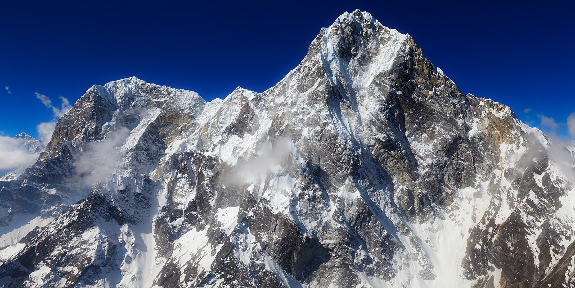
Summit of Ama Dablam, aerial photo

Aerial photo of mountain Ama Dablam

Dhaulagiri is the seventh highest mountain in the world at 8,167 metres (26,795 ft) above sea level.
The mountain's name is धौलागिरी (dhaulāgirī) in Nepali. This comes from Sanskrit where धवल (dhawala) means dazzling, white, beautiful and गिरि (giri) means mountain.

"SOLAR WIND"
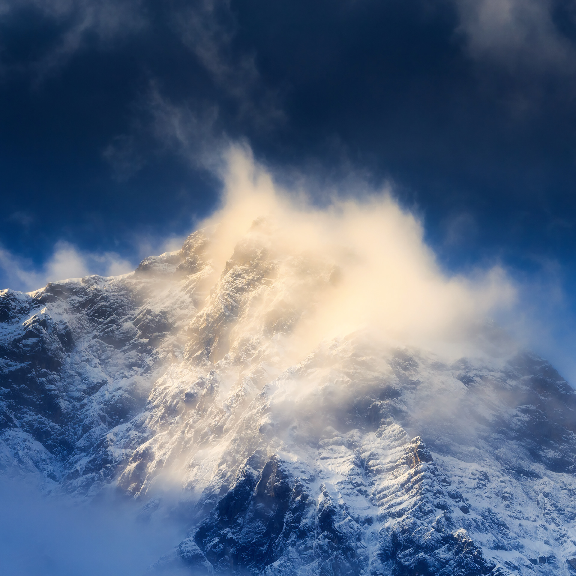
A strong wind blows away clouds and snow from one of the Himalayn peaks, lit by morning light, Manaslu Conservation Area

Morning light on a faces of Annapurna Massif, Annapurna Conservation Area
Sacred mountain Machapuchare ("Fish Tail") at the sunset, Annapurna Conservation Area
Glacier and sunset light on peaks of Annapurna Massif, Annapurna Conservation Area 
Highland river in himalayan forest, Manaslu Conservation Area
Mountain lake on Shipton La pass, Makalu-Barun National Park
Manaslu - is the eighth highest mountain in the world at 8,163 metres (26,781 ft) above sea level. It is located in the Mansiri Himal, part of the Nepalese Himalayas, in the west-central part of Nepal. Its name, which means "mountain of the spirit", comes from the Sanskrit word manasa, meaning "intellect" or "soul". Manaslu was first climbed on May 9, 1956 by Toshio Imanishi and Gyalzen Norbu, members of a Japanese expedition. It is said that "just as the British consider Everest their mountain, Manaslu has always been a Japanese mountain"
Morning in Himalayas, Manaslu Conservation Area
First light on Larkya Peak, Manaslu Conservation Area

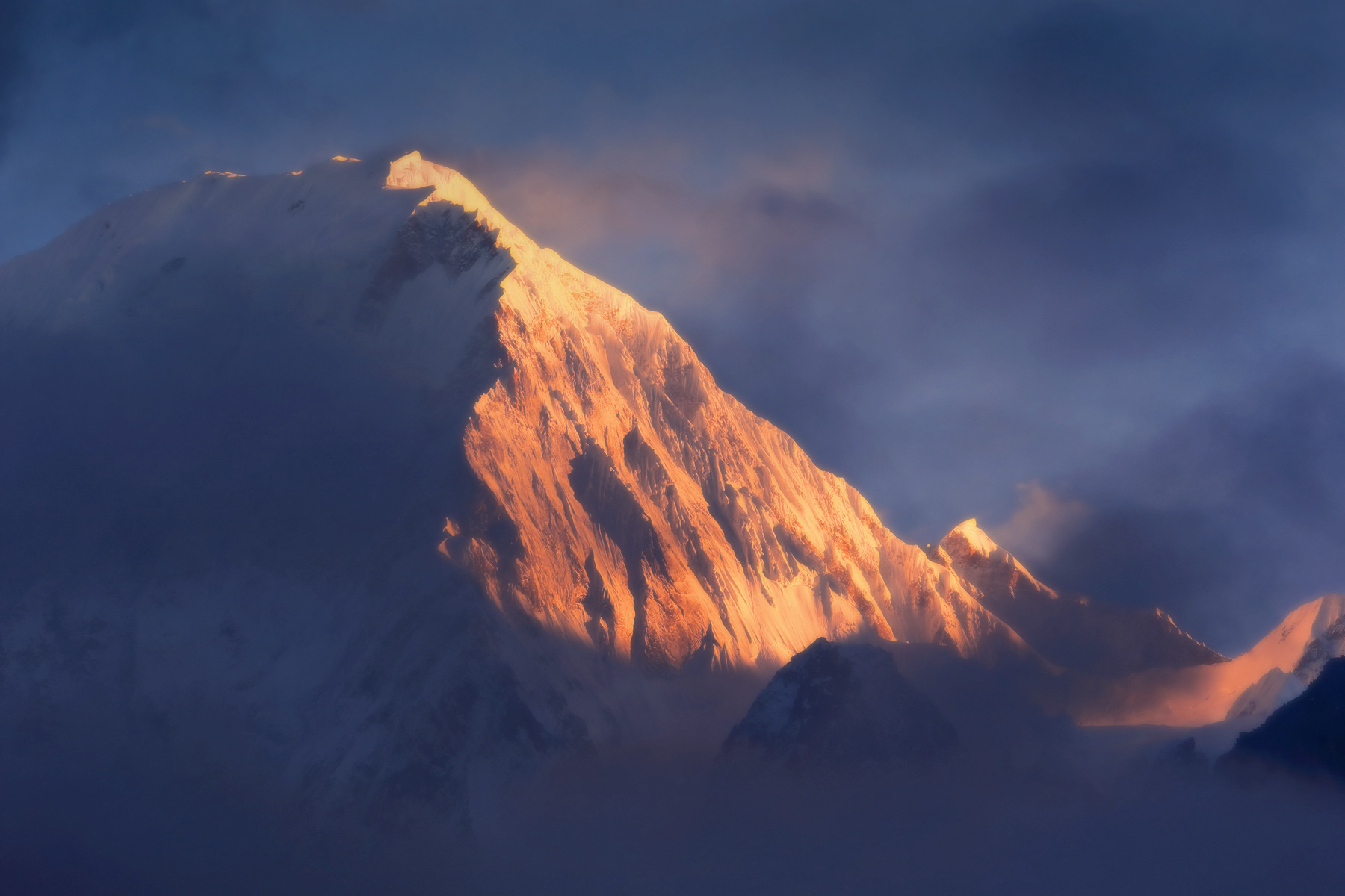
After sunset, Makalu-Barun National Park

Few minutes before sunrise, on a way up to Larkya Pass (5106 m). View on mountain Pang Phuchi at the left (Panpoche Himal, Samdo, 6620 m) with four peaks 6567m, 6485 m, 6260 m and 6504 m.

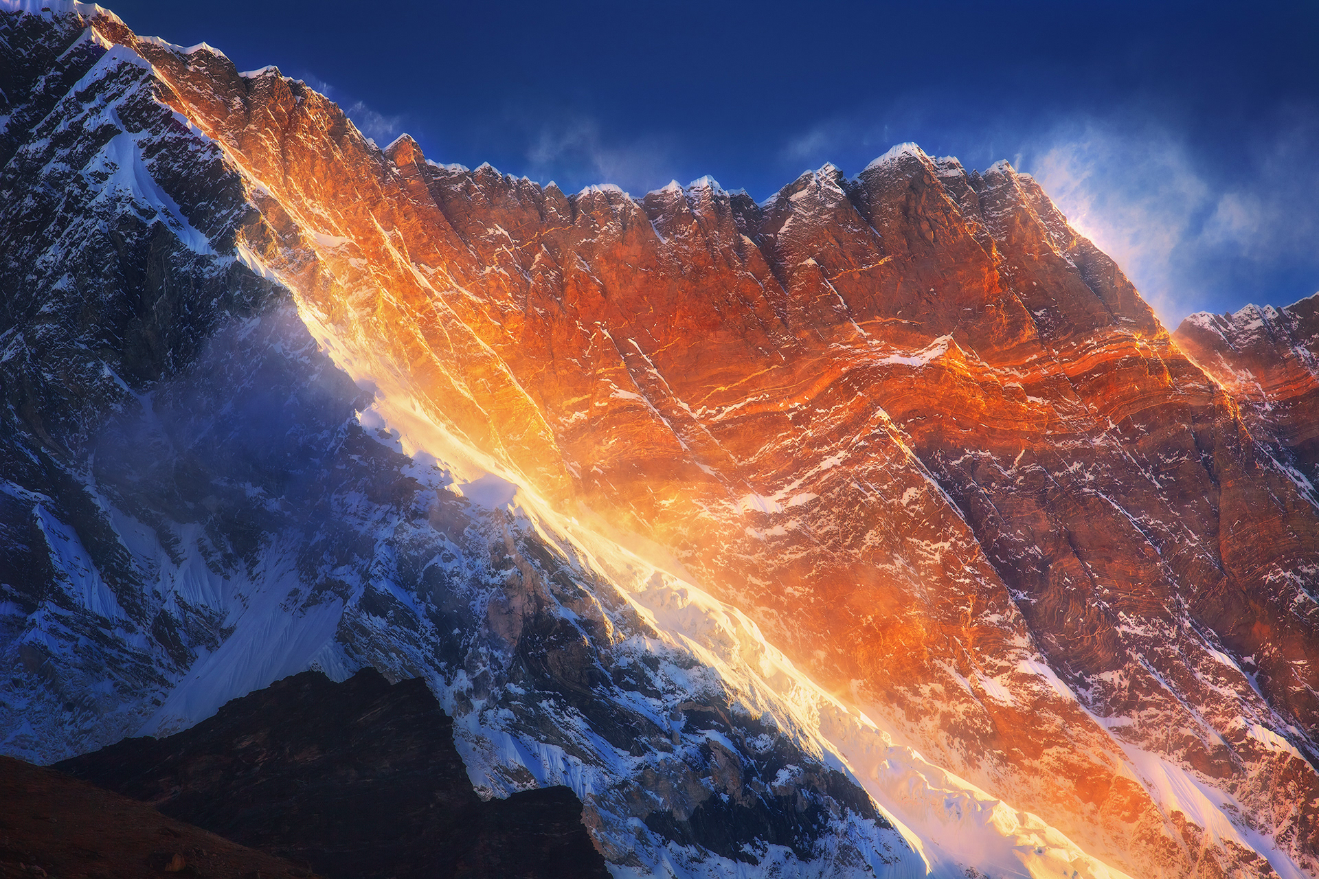
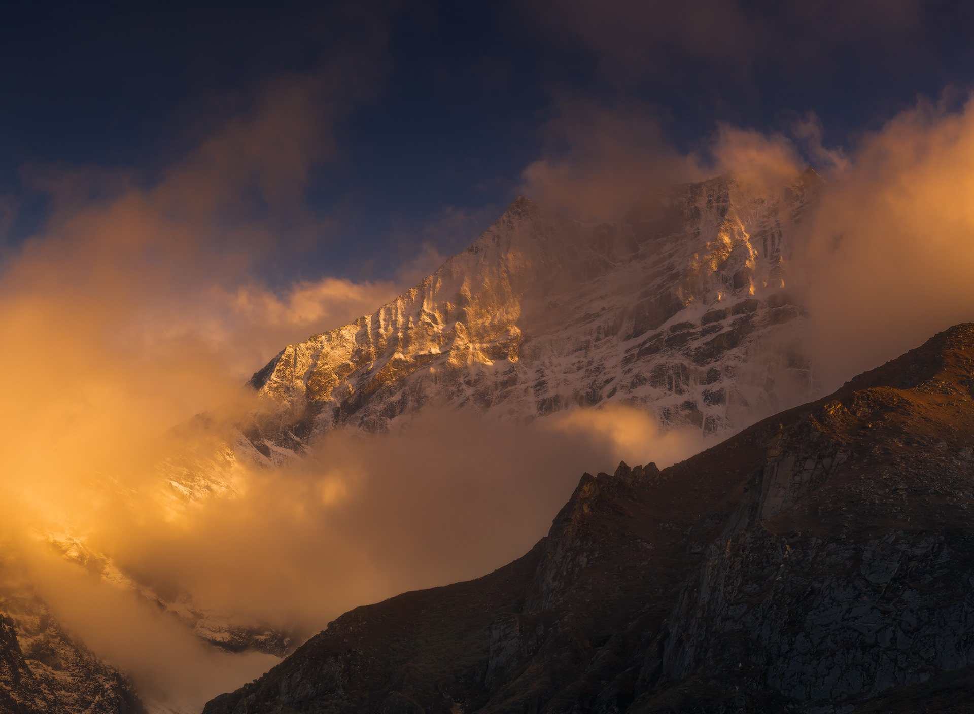
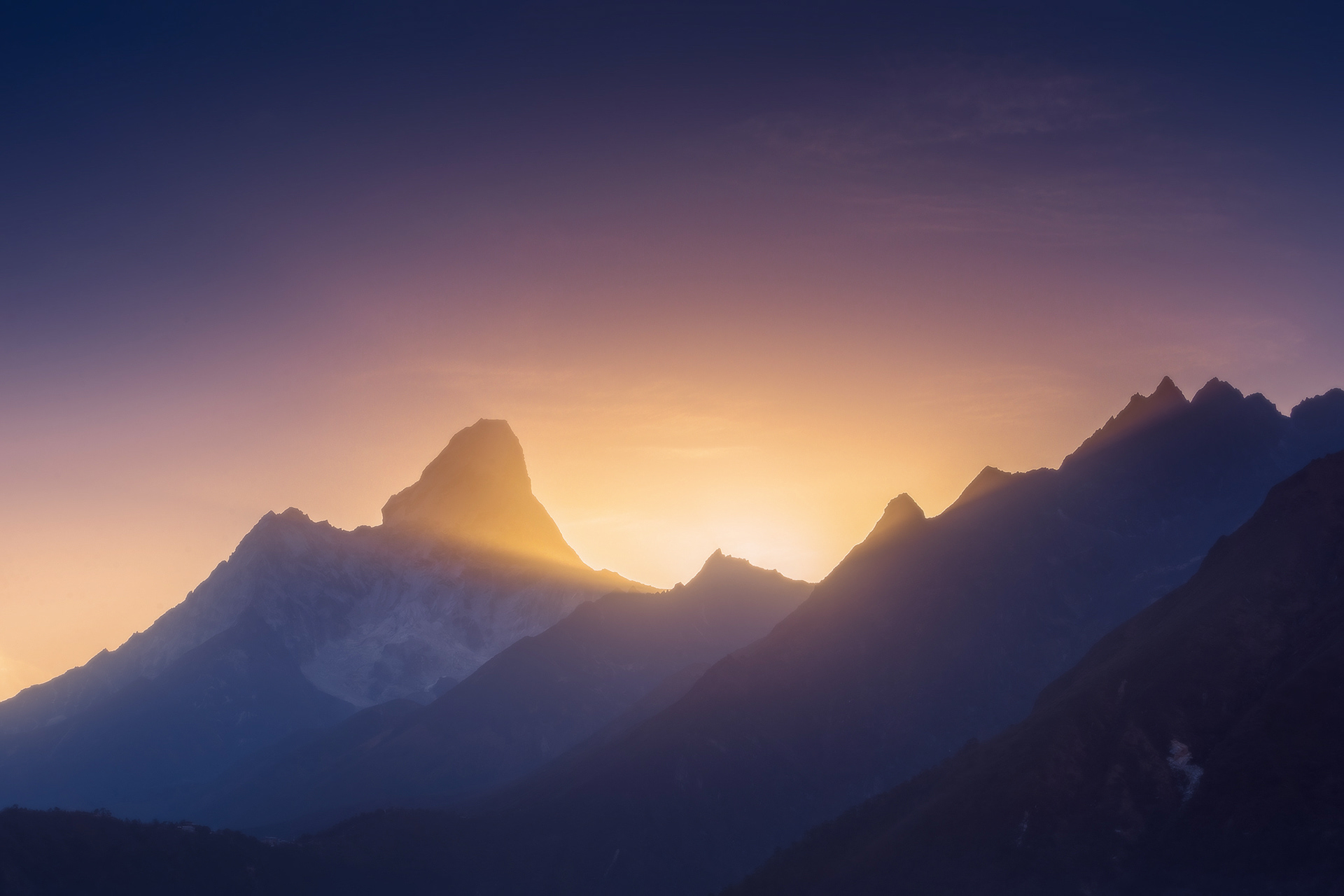
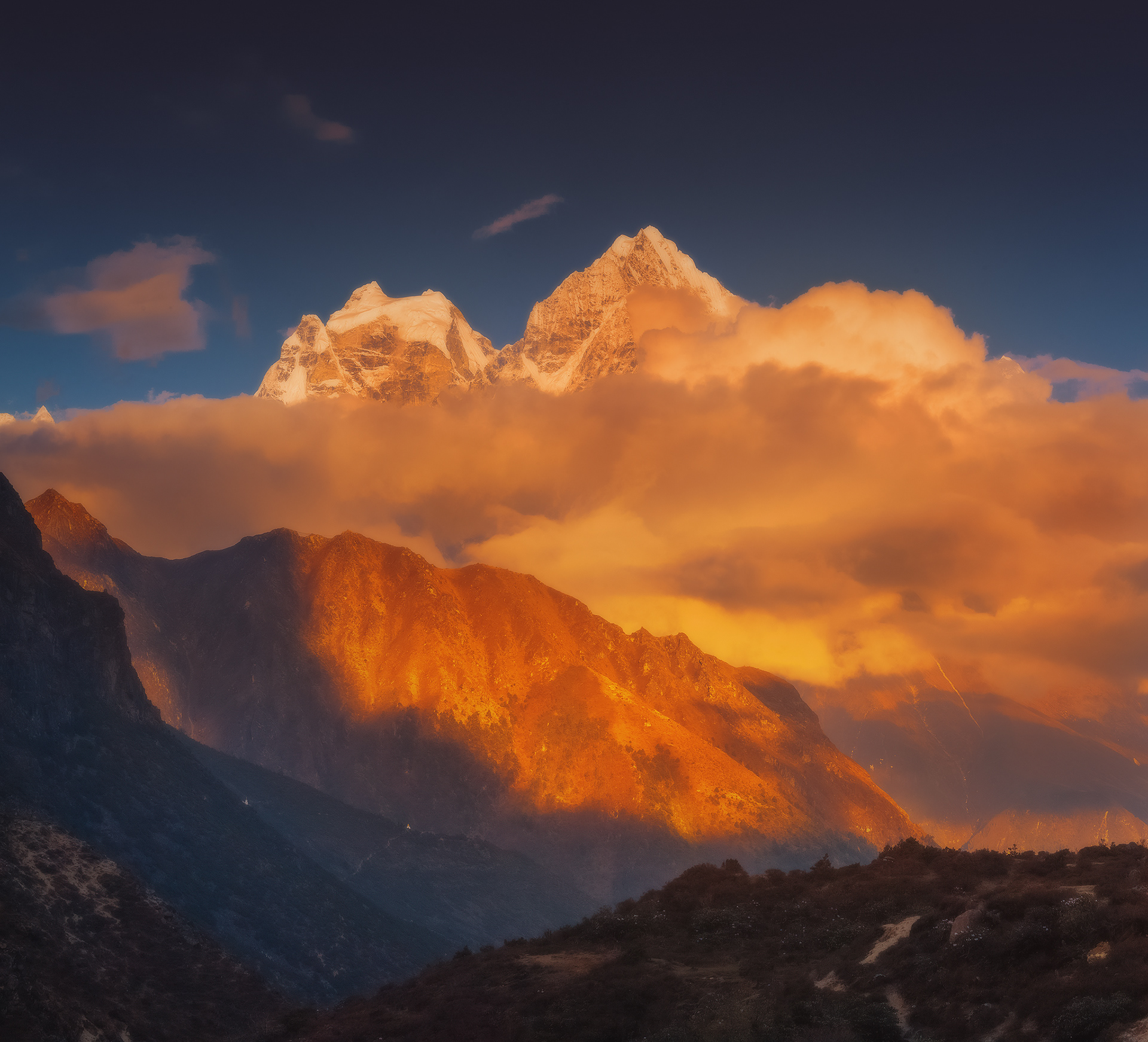
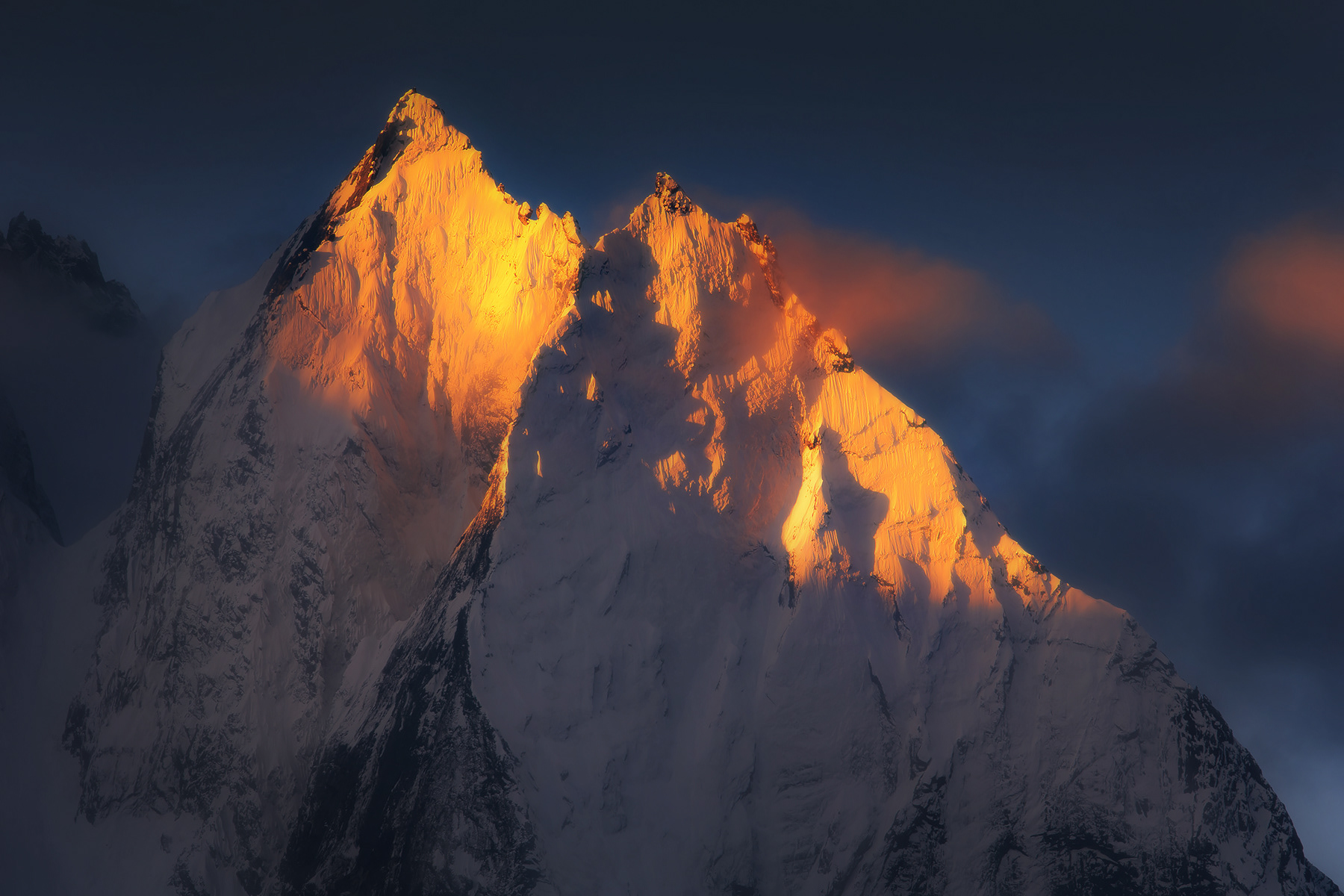
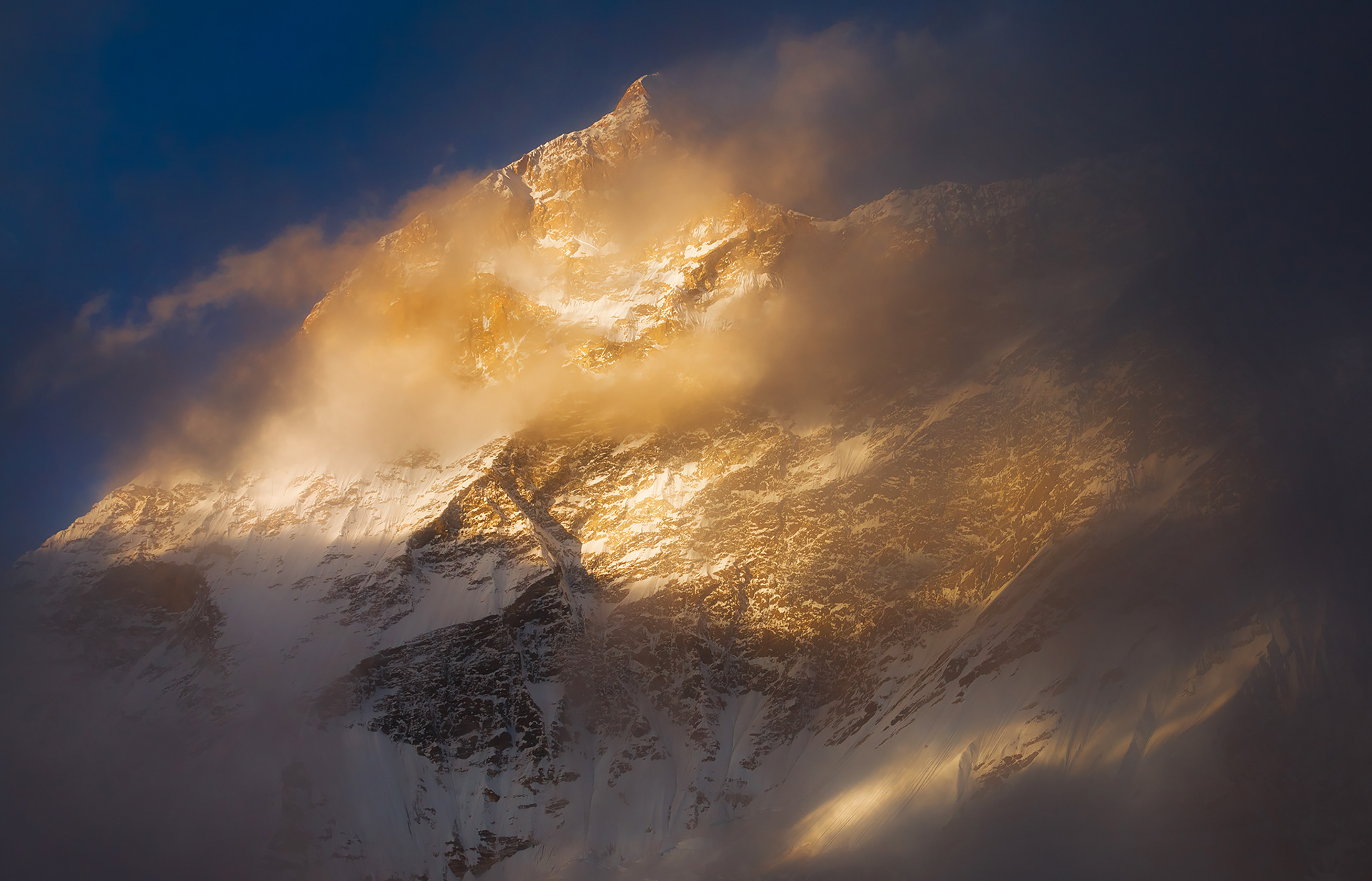
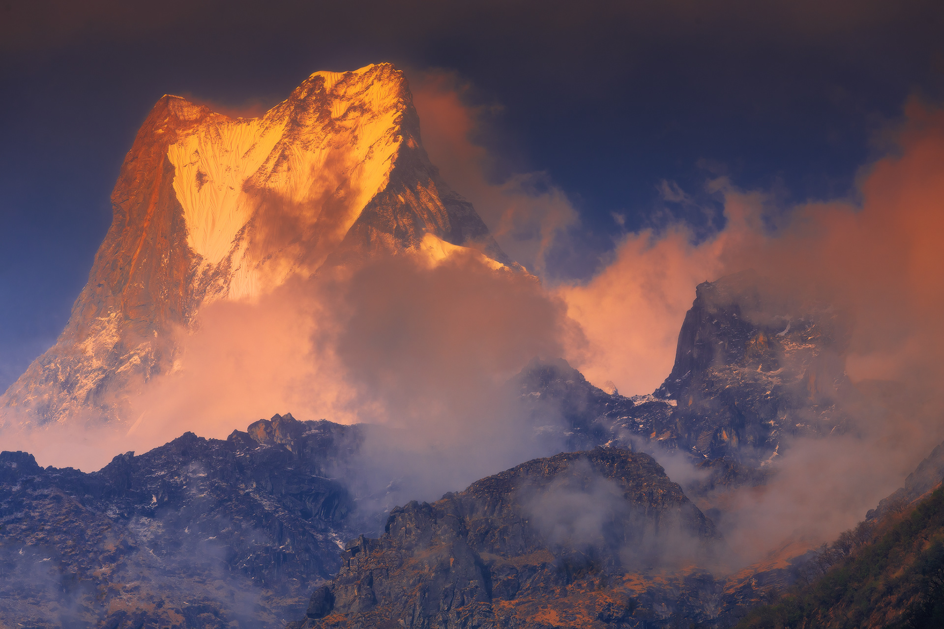
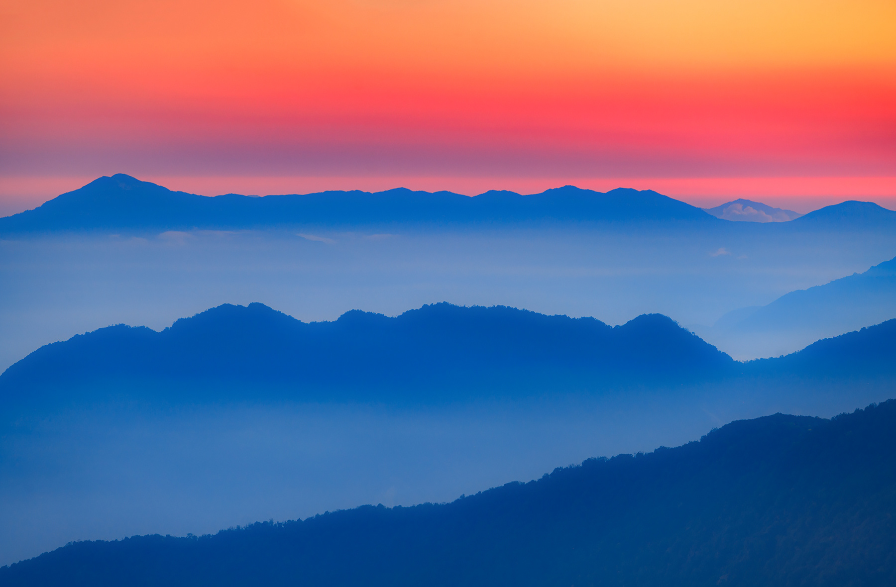
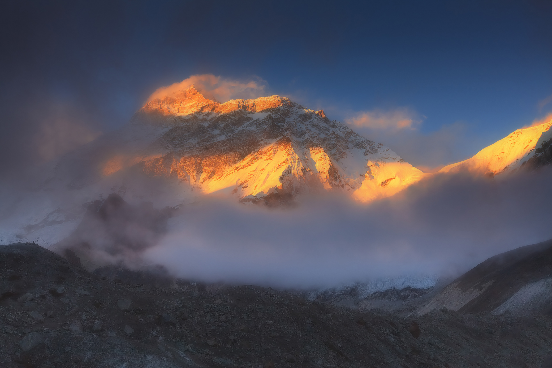
The setting sun illuminates the clouds swirling over the Himalayan peaks

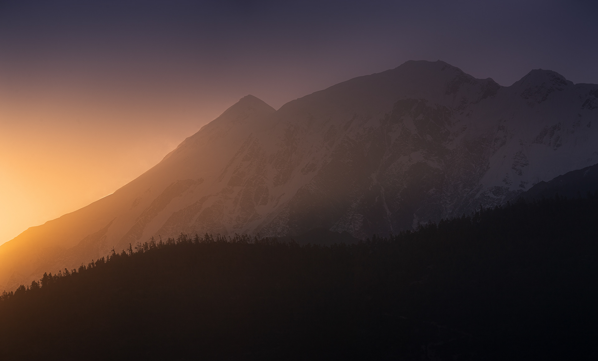
First light of sunrise behind Tilicho Peak

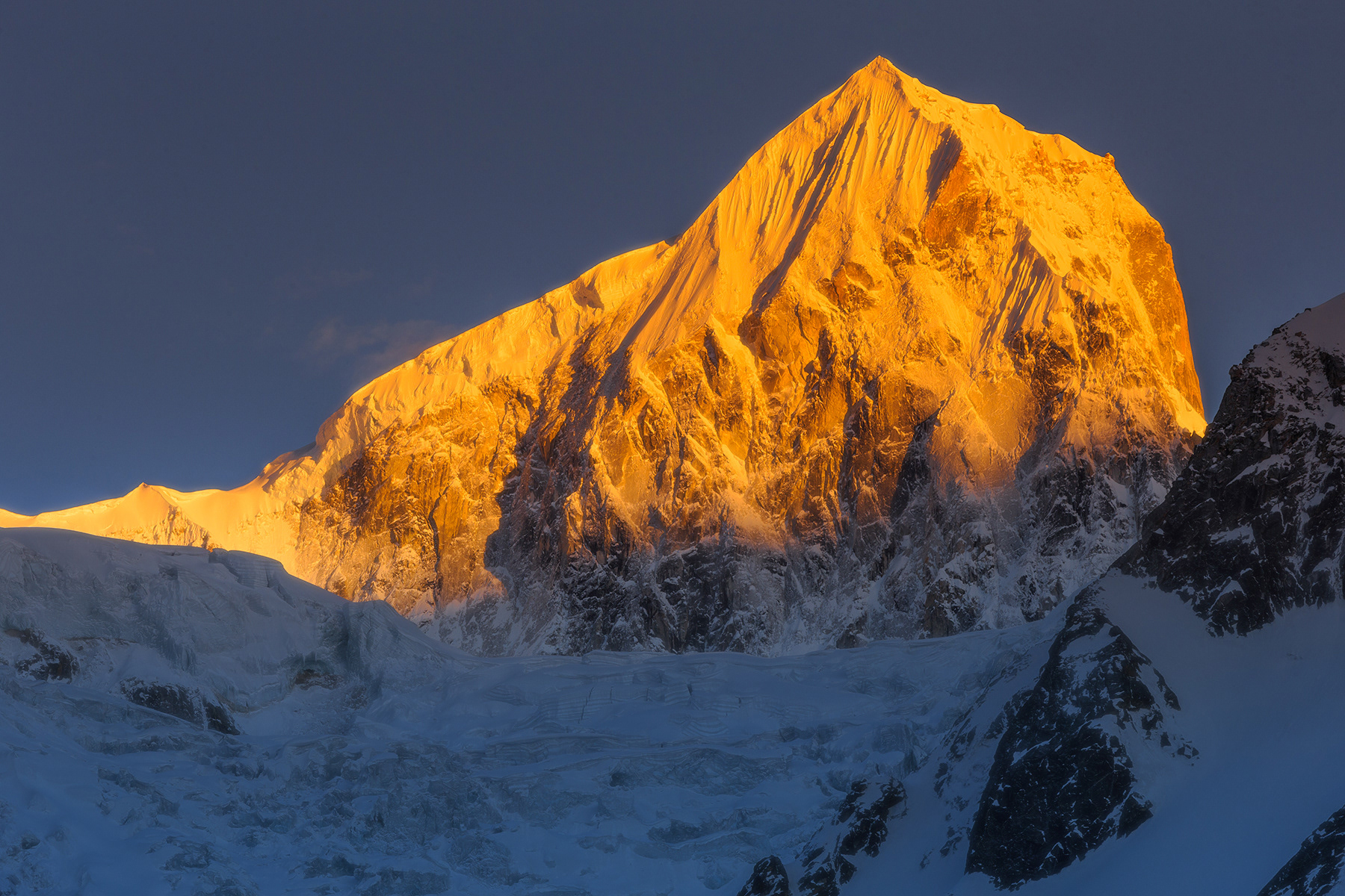
Mountain Makalu - the fifth summint of Planet - on sunset

You may also like

Back to Top