
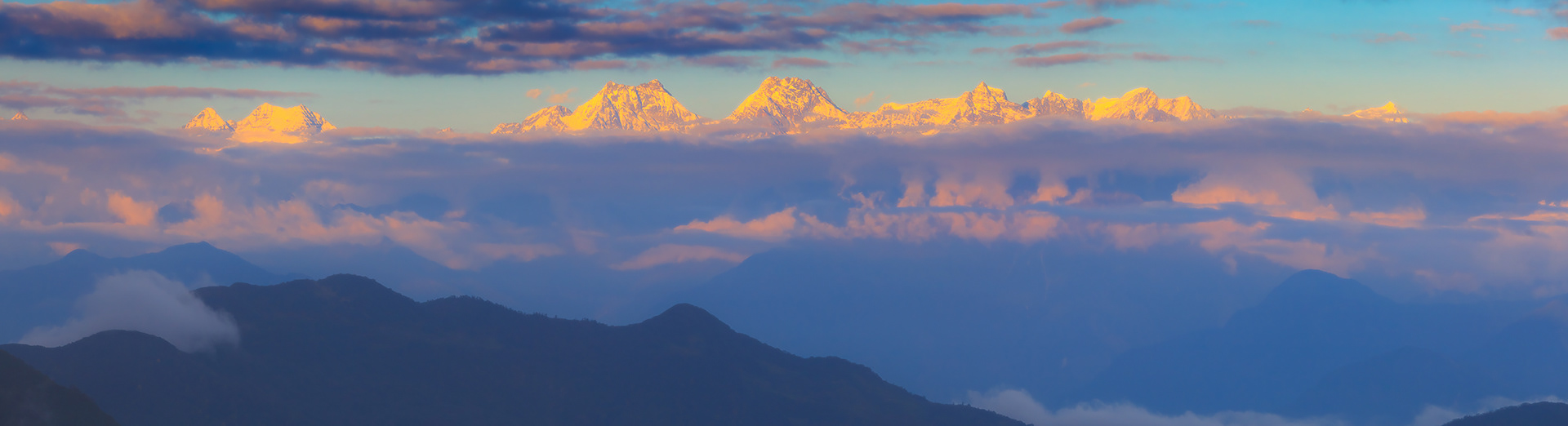
Sunset view on Pharilapche peak (left side), Gokyo Lake and Gokyo Ri (5483 m) from moraine of Ngozumpa Glacier. Sagarmatha National Park
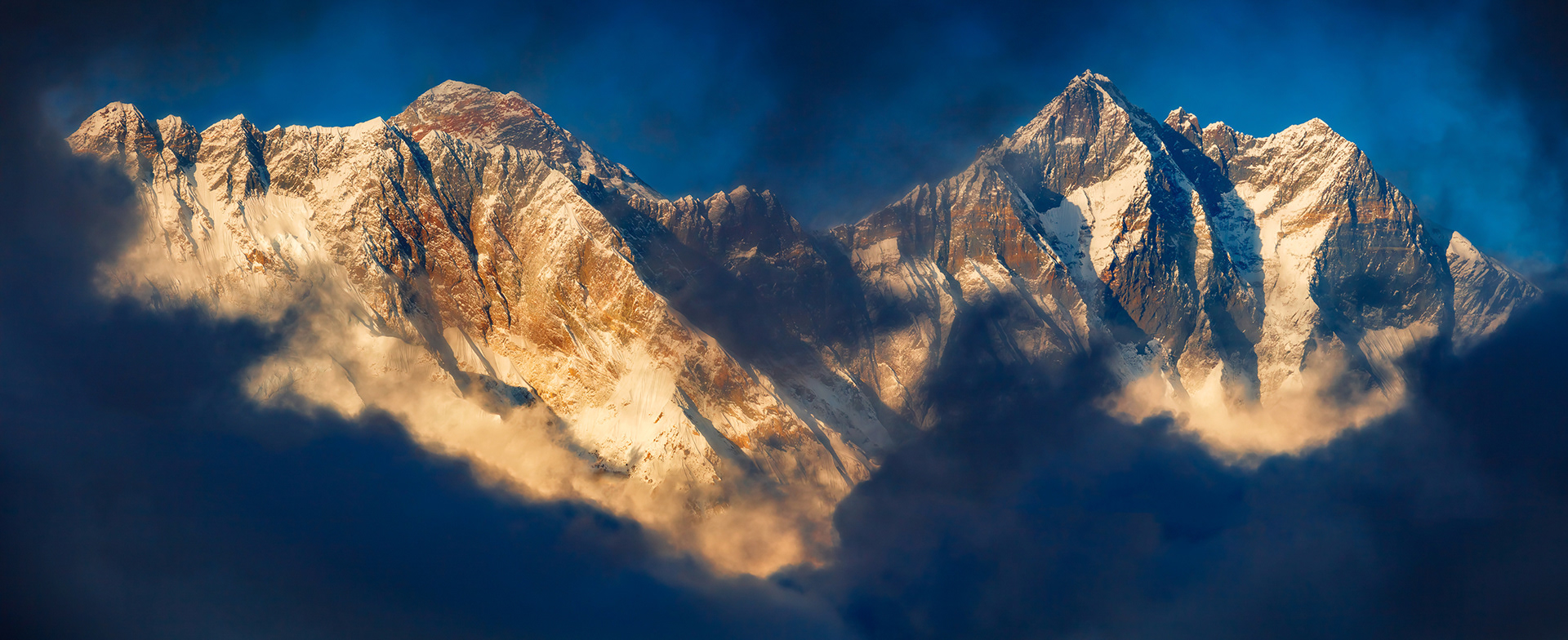
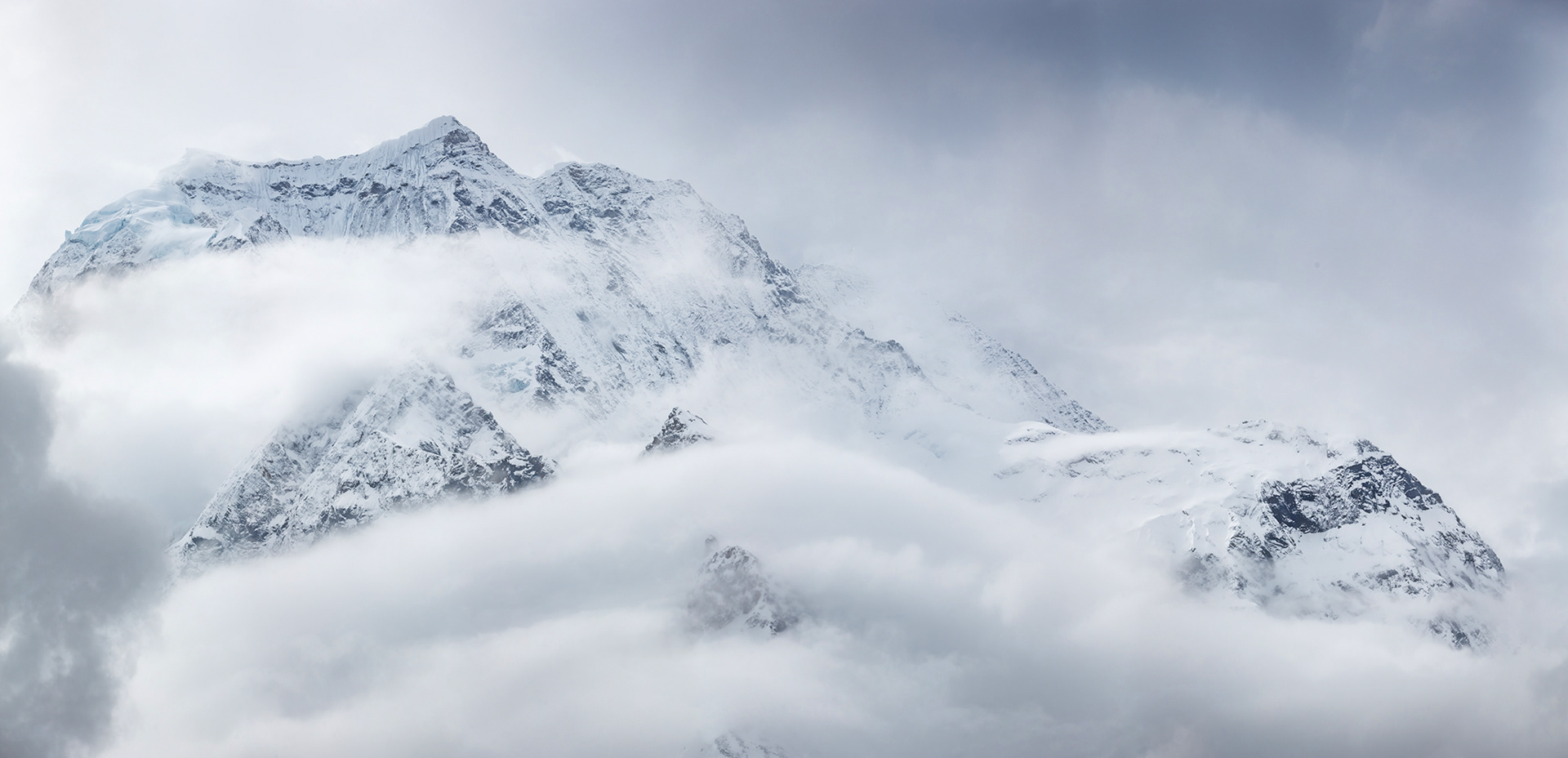
Lhotse (at the right) is the fourth highest mountain in the world at 8,516 metres (27,940 ft), after Mount Everest, K2, and Kangchenjunga. Part of the Everest massif, Lhotse is connected to the latter peak via the South Col. Lhotse means “South Peak” in Tibetan. In addition to the main summit at 8,516 metres (27,940 ft) above sea level, the mountain comprises the smaller peaks Lhotse Middle (East) at 8,414 m (27,605 ft), and Lhotse Shar at 8,383 m (27,503 ft). The summit is on the border between Tibet (China) and the Khumbu region of Nepal.
Nuptse (left part of photo) lies two kilometres WSW of Mount Everest (left behind Nuptse). Nuptse is Tibetan for "west peak", as it is the western segment of the Lhotse-Nuptse massif.
The long east-west trending main ridge of Nuptse is crowned by seven peaks, Main peak is 7,861 meters.
Nuptse (left part of photo) lies two kilometres WSW of Mount Everest (left behind Nuptse). Nuptse is Tibetan for "west peak", as it is the western segment of the Lhotse-Nuptse massif.
The long east-west trending main ridge of Nuptse is crowned by seven peaks, Main peak is 7,861 meters.
Mountain Thamserku, Sagarmatha National Park
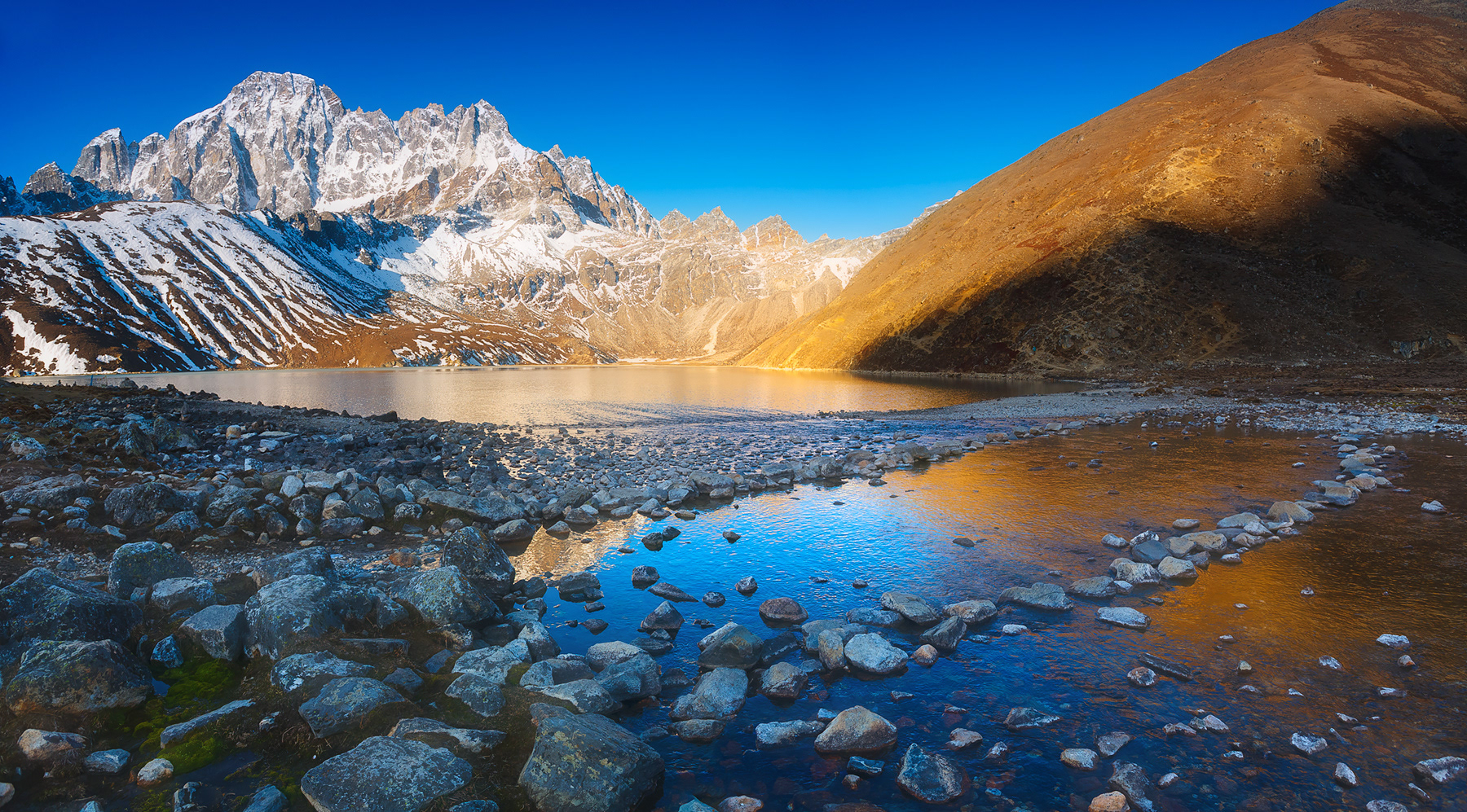
Morning on Gokyo Lake and Pharilapche Peak, Sagarmatha National Park
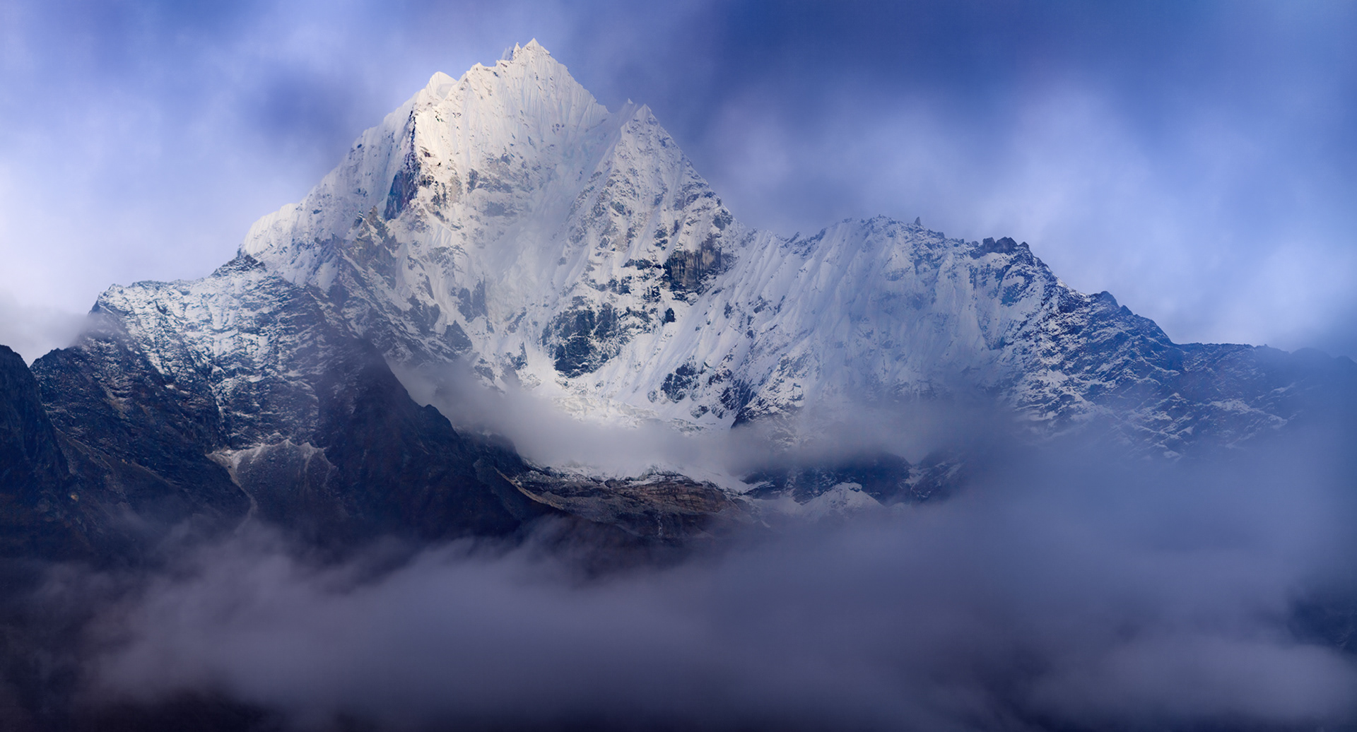
Ama Dablam is a mountain in the Himalaya range of eastern Nepal. The main peak is 6,812 metres (22,349 ft), the lower western peak is 6,170 metres (20,243 ft). Ama Dablam means "Mother's necklace"; the long ridges on each side like the arms of a mother (ama) protecting her child, and the hanging glacier thought of as the dablam, the traditional double-pendant containing pictures of the gods, worn by Sherpa women. For several days, Ama Dablam dominates the eastern sky for anyone trekking to Mount Everest basecamp. For its soaring ridges and steep faces Ama Dablam is sometimes referred as the "Matterhorn of the Himalayas."
Clouds covering Samdo Peak, Manaslu Conservation Area
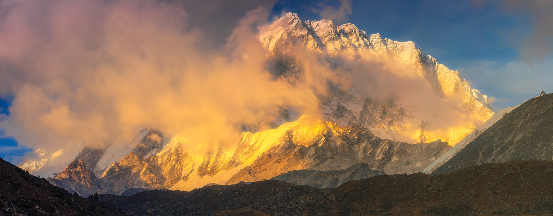
Nuptse is a mountain in the Khumbu region of the Mahalangur Himal, in the Nepalese Himalayas. It lies two kilometres WSW of Mount Everest. Nuptse is Tibetan for "west peak", as it is the western segment of the Lhotse-Nuptse massif. The long east-west trending main ridge of Nuptse is crowned by seven peaks.
The main peak, Nuptse I, was first climbed on May 16, 1961 by Dennis Davis and Sherpa Tashi and the following day by Chris Bonington, Les Brown, James Swallow and Pemba Sherpa, members of a British expedition led by Joe Walmsley. After a long hiatus, Nuptse again became the objective of high-standard mountaineers in the 1990s and 2000s, with important routes being put up on its west, south, and north faces.
The main peak, Nuptse I, was first climbed on May 16, 1961 by Dennis Davis and Sherpa Tashi and the following day by Chris Bonington, Les Brown, James Swallow and Pemba Sherpa, members of a British expedition led by Joe Walmsley. After a long hiatus, Nuptse again became the objective of high-standard mountaineers in the 1990s and 2000s, with important routes being put up on its west, south, and north faces.
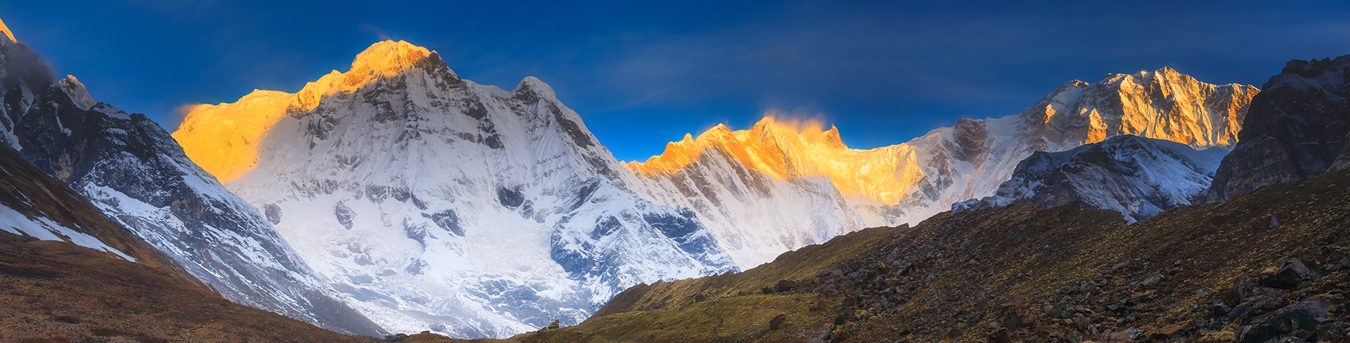
Sunrise at main peaks of Annapurna Sanctuary: Annapurna South (left) and Annapurna I (right).
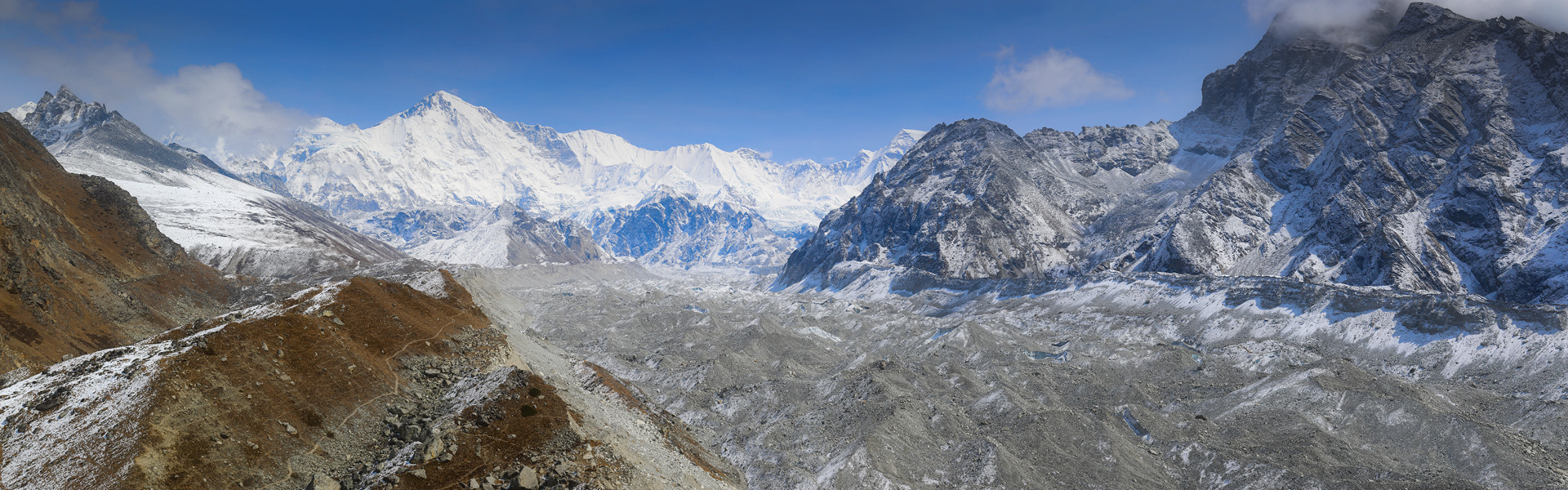
View from moraine of Ngozumpa Glacier on mountain Cho Oyu, Sagarmatha National Park. Cho Oyu is the sixth highest mountain in the world at 8,188 metres (26,864 ft) above sea level. Cho Oyu means "Turquoise Goddess" in Tibetan. The mountain is the westernmost major peak of the Khumbu sub-section of the Mahalangur Himalaya 20 km west of Mount Everest. The mountain stands on the China-Nepal border.Just a few kilometres west of Cho Oyu is Nangpa La (5,716m/18,753 ft), a glaciated pass that serves as the main trading route between the Tibetans and the Khumbu's Sherpas. This pass separates the Khumbu and Rolwaling Himalayas. Due to its proximity to this pass and the generally moderate slopes of the standard northwest ridge route, Cho Oyu is considered the easiest 8,000 metre peak to climb. It is a popular objective for professionally guided parties.